How difficult is the steep gravel road to Kavakdağı Tepesi in Turkey?
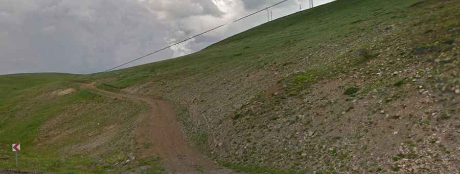
Kavakdağı Tepesi is a high mountain peak at an elevation of 2,428 meters (7,965 ft) above sea level in Erzurum Province, Eastern Anatolia Region, Turkey. The summit is reached via a short, unpaved spur track starting from Gölyurt Geçidi on the D925 highway.
| Road facts: Kavakdağı Tepesi | |
|---|---|
| Location | Erzurum Province, Eastern Anatolia (Turkey) |
| Elevation | 2,428 m (7,965 ft) |
| Length | 3.1 km (1.92 miles) from Gölyurt Geçidi (D925) |
| Elevation Gain | 78 m (256 ft) |
| Max Gradient | 12% |
| Surface | Unpaved (Rough gravel, loose stones, and dirt) |
| Vehicle Required | High-clearance 4x4 with low range |
Where is the road to Kavakdağı Tepesi located?
The track branches off from the Gölyurt Geçidi mountain pass on the paved D925 highway. The 3.1-kilometer gravel route climbs 78 vertical meters to reach the 2,428-meter peak.
What are the driving conditions on the Kavakdağı Tepesi track?
The 3.1-kilometer trail is unpaved, consisting of loose gravel, dirt, and jagged stones. Steeper ramps reach gradients of 12%. A high-clearance 4x4 with low range is required to avoid spinning wheels on loose stone or clipping undercarriage components on rock obstacles.
What hazards exist on the route to Kavakdağı Tepesi?
The single-lane path features narrow switchbacks with soft, uncompacted edges. Descending the 12% gravel inclines requires lower gear selection to engine brake and maintain control on shifting gravel. Sudden storms can rapidly turn the dry surface into slick mud.
Is the road to Kavakdağı Tepesi open in winter?
No. Heavy snowfall blocks the high-altitude track for over half the year, leaving the summit impassable from late October through early June.