How to drive the unpaved road to Tekfur Tepesi?
Tekfur Tepesi is a high mountain pass at an elevation of 3.075m (10,088ft) above sea level, located in Rize Province of Turkey. It’s one of the highest roads in the country.
Where is Tekfur Tepesi?
The pass is located in the Black Sea region, in the northeastern part of the country.
Is Tekfur Tepesi unpaved?
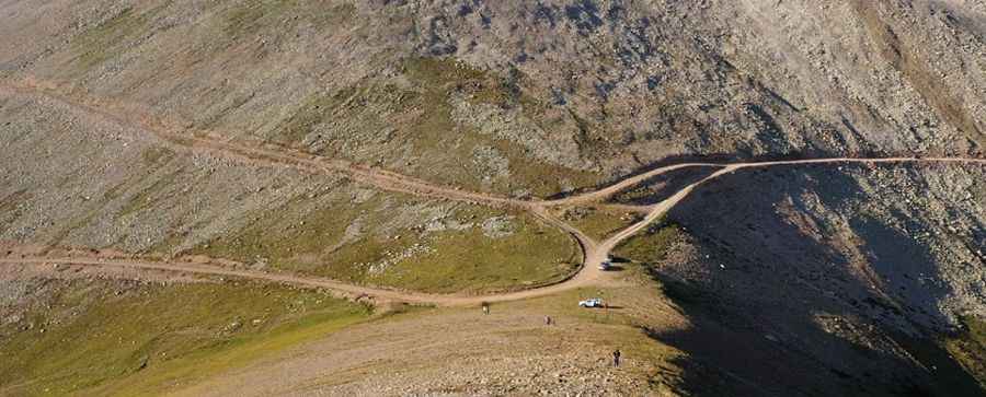
The road to the summit is totally unpaved. It’s a shelf road carved into the mountainside, extremely narrow, totally impassable for 2 cars. A 4x4 vehicle is required. It comprises 18 hairpin turns.
How long is the road to Tekfur Tepesi?
Starting from Ortaklar, the road to the summit is 11 km long. Over this distance, the elevation gain is 859 m and the average gradient is 7.80%. The road ends near the summit at Cahpeyik yaylası.
Is the road to Tekfur Tepesi open year-round?
The road is totally impassable in winters due to the heavy snowfalls in the area.
Pic: Rehbersiz :/