Tahir Gediği: Driving the 3,022m unpaved track in Erzurum
Tahir Gediği is a high mountain pass at an elevation of 3,022m (9,914ft) above sea level, located in the Erzurum Province of eastern Turkey. Situated southeast of the city of Erzurum, it is one of the highest mountain passes of Turkey. The road is a primitive, unpaved track that scales the southern ridges of the Palandöken Mountains, crossing a barren and high-altitude landscape.
| Road facts: Tahir Gediği | |
|---|---|
| Location | Erzurum Province, Turkey |
| Elevation | 3,022 m (9,914 ft) |
| Length | 6.8 km from Palandöken junction |
| Surface | Unpaved / Loose gravel |
Where does the road to Tahir Gediği start?
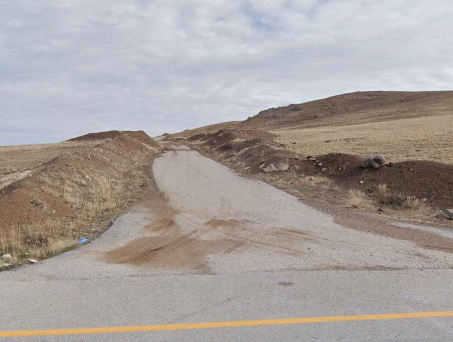
The climb begins at the junction with the paved road leading to the Palandöken Geçidi. From this point, the track heads into a much more isolated and less maintained sector. The route is 6.8 km long and reaches the summit at 3,022 meters. It is a high-altitude out-and-back or seasonal transit where no services, mobile signal, or mechanical assistance are available.
Is the road to Tahir Gediği suitable for 4x4 only?
Yes, a 4x4 vehicle is mandatory for this crossing. The road is entirely unpaved and consists of a mix of crushed rock, natural earth, and sharp volcanic stones. The primary hazard is the presence of sudden loose-gravel breaks where traction is lost instantly. Standard cars or low-clearance vehicles will likely hit the underbody on the high center ridges of the track or get stuck in the soft shoulders after localized rockfall.
How steep is the climb from the Palandöken junction?
Over the 6.8-kilometer distance, the road gains 326 meters in elevation. While the average gradient is 4.79%, this figure is misleading. The track features several flat sections followed by short, aggressive ramps where the gradient increases significantly. At over 3,000 meters, naturally aspirated engines suffer a loss of power due to the thin air, requiring the use of low gears to maintain a steady torque and avoid wheel spin on the loose surface.
When is the Tahir Gediği pass open?
The road is subject to heavy snowfall and remains impassable for most of the year, typically from late October until June. Even in mid-summer, a single rainstorm can wash out sections of the track, turning the mountain soil into a slippery film that makes steering unpredictable. Because the pass is not part of the main regional logistics network, snow removal is not a priority, and the track can remain blocked by drifts long after the main Palandöken road has been cleared.
What are the hazards of driving this Erzurum pass?
The main hazards are the extreme isolation and the unpredictable surface. The track is narrow and lacks any safety barriers, with vertical drops into the barren valleys below. On the descent, engine braking is essential to prevent brake fade on the steep gravel ramps. Drivers must be alert for sudden changes in road width and for local livestock or agricultural machinery that may block the entire lane on the most exposed corners of the summit ridge.