How to drive the paved road to Bakirlitepe Mountain?
Bakırlıtepe is a high mountain peak at an elevation of 2.462m (8,077ft) above sea level, located in Saklikent region of Turkey.
Where is Bakırlıtepe?
The peak is located in the Antalya province, on the Mediterranian coast of Turkey.
Why is there a road to the summit of Bakırlıtepe?
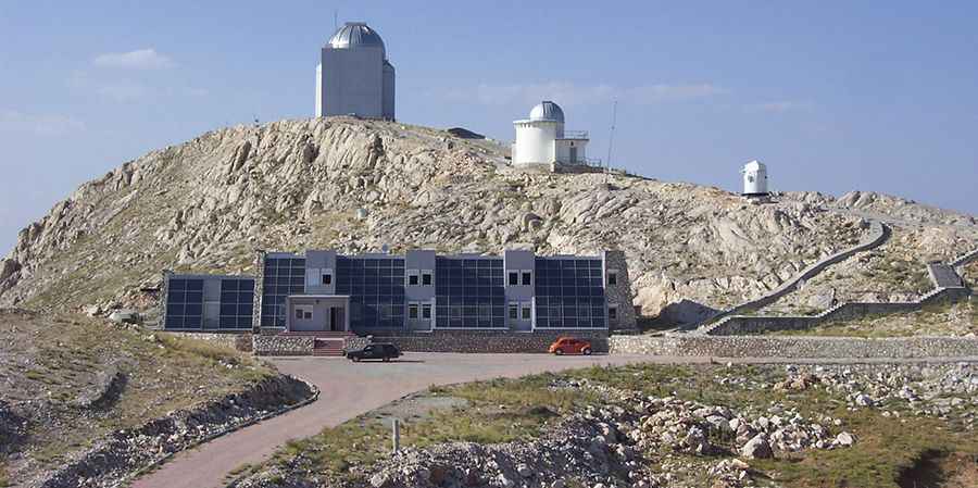
At the summit sits the TÜBİTAK National Observatory (TUG), a ground-based astronomical observatory. The road was built in 1997.
Is the road to Bakırlıtepe paved?
The road to the summit is paved, yet very defiant, with very steep parts and 17 hairpin turns. It is subject to winter snowfalls with such a high summit altitude.
How long is the road to Bakırlıtepe?
Starting from Saklıkent, the road to the summit is 5.4 km long. Over this distance, the elevation gain is 471 m and the average gradient is 8.72%.
Pic: http://astroa.physics.metu.edu.tr/tug/100_0037.jpg