How to to drive the extreme unpaved road to Topuzdüzü Tepesi in Gümüşhane?
Topuzdüzü Tepesi is a high mountain peak at an elevation of 2,518m (8,261ft) above sea level, located in the Gümüşhane Province of Turkey. The 5.2 km road to the communication tower at the summit is a steep gravel path with a 14.63% average gradient.
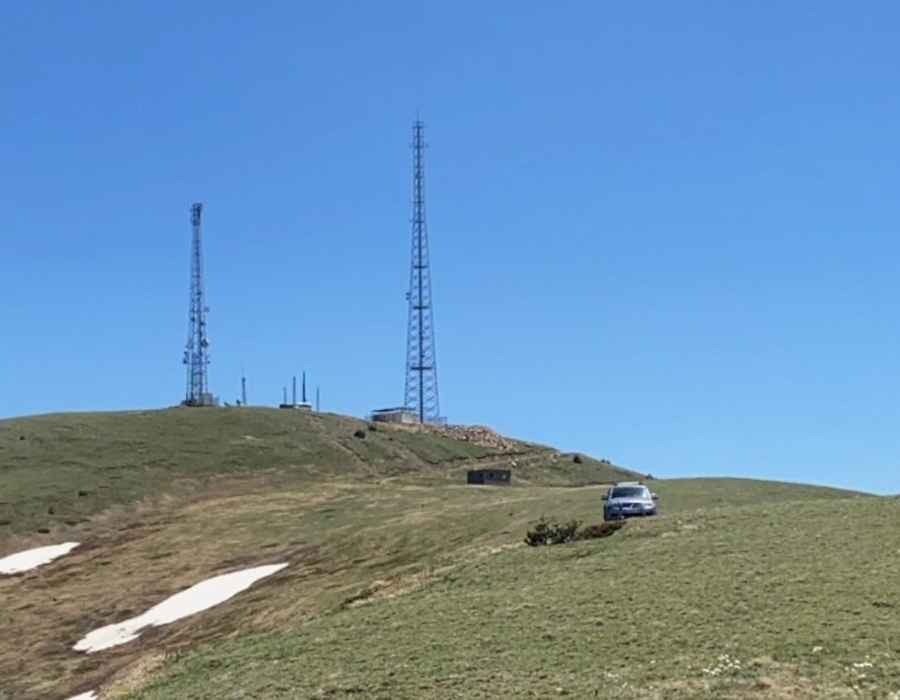
| Road facts: Topuzdüzü Tepesi | |
|---|---|
| Location | Gümüşhane, Turkey |
| Elevation | 2,518 m (8,261 ft) |
| Length | 5.2 km (3.2 miles) |
| Average Gradient | 14.63% |
| Surface | Loose Gravel / Dirt |
Why is there a road to Topuzdüzü Tepesi?
The road is a dead-end service track used for maintenance of the peak's communication infrastructure.
How long is the road to Topuzdüzü Tepesi?
Starting from Tokçam, the road to the summit is 5.2 km long. Over this distance, the elevation gain is 761m and the average gradient is 14.63%.
Is the road to Topuzdüzü Tepesi unpaved?
The surface is entirely unpaved, consisting of a mix of loose gravel and hard-packed dirt, with sliding stones, heavily rutted by heavy vehicles. There are no guardrails, and the track features tight hairpins where the vehicle sits just centimeters away from unprotected drops.
Can I drive my vehicle to Topuzdüzü Tepesi?
Due to the surface of the road, a high-clearance 4x4 with low-range gears vehicle is required. The track is remote, with zero passing traffic and no recovery services available. It is essential to carry a full-sized spare and recovery gear, as a single landslide or mechanical failure can leave you stranded at high altitude.
Is the road to Topuzdüzü Tepesi open year-round?
Located in the Black Sea region, the peak is buried under heavy snow for most of the year. Snow drifts often block the path well into the summer months. After rainfall, the limestone dust and gravel turn into a slick slurry, making the steep ramps impassable even for 4WD vehicles.
Pic: Abdul Baki Genç