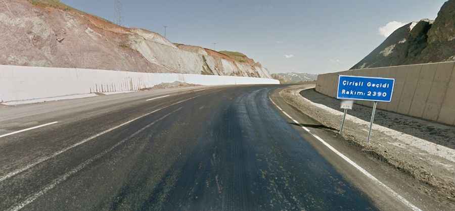
Things to Know Before Driving through Çirisli Geçidi
Çirisli Geçidi is a high mountain pass at an elevation of 2.320m (7,611ft) above sea level, located in Erzurum Province, Turkey.
Where is Çirisli Geçidi?
The pass is situated in the Eastern Anatolia region, in the northeastern part of the country. A minor unpaved mining road to the north of the pass climbs up to 2.618m (8,589ft) above sea level.
Is Çirisli Geçidi paved?
The road to the summit is entirely paved but in pretty bad condition. It’s called D950 State Road.
How long is Çirisli Geçidi?
The pass is 58.2 km (36.16 miles) long, running north-south from Çat (in Erzurum Province) to Karlıova (in Bingöl Province).
Is Çirisli Geçidi challenging?
The road to the summit is heavily used by trucks. It has very steep sections, with some ramps reaching an 11% maximum gradient. When snow falls, which occurs in the winter, conditions become tough and slippery. It is subject to winter storms.