Çatalören Geçidi: Driving the high-altitude D955 in Erzurum
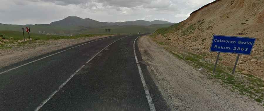
Çatalören Geçidi is a high mountain pass at an elevation of 2,363 meters (7,752 ft) above sea level in Erzurum Province, Eastern Anatolia, Turkey. Situated on the paved D955 highway (Tutak Karayazı Yolu), the pass links the towns of Karayazı and Tutak across the high-altitude plateau of the Armenian Highlands.
| Road facts: Çatalören Geçidi (D955) | |
|---|---|
| Location | Karayazı to Tutak, Erzurum, Eastern Anatolia (Turkey) |
| Elevation | 2,363 m (7,752 ft) |
| Road Name | D955 (Tutak Karayazı Yolu) |
| Length | 11.0 km (6.8 miles) between Çatalören and Kırgındere |
| Surface | Paved asphalt (Two-lane highway) |
Where is the D955 Çatalören Geçidi located?
The 11.0-kilometer pass segment runs along the D955 highway between the villages of Çatalören and Kırgındere, in the eastern high plateau of Erzurum Province.
What are the driving conditions on the D955 pass?
The 11-kilometer route is fully paved, carrying heavy commercial truck traffic that creates ruts in the asphalt. Exposed on a treeless plateau at 2,363 meters elevation, the road subjects vehicles to strong lateral crosswinds, while thin air causes power loss in naturally aspirated engines on the long incline ramps.
What hazards exist on Çatalören Geçidi in winter?
Located in one of the coldest regions of Turkey, the pass is subject to severe winter blizzards, ground drift snow, and black ice. Heavy snowfall frequently causes temporary closures on the D955 between November and April, with extreme sub-zero temperatures posing freezing risks for vehicle fuel lines and batteries.
Is the D955 road open year-round?
State snowplows maintain the D955 highway year-round, but severe ground blizzards (*tipi*) and zero-visibility conditions force sudden winter road closures between Karayazı and Tutak.