The difficult road to Vercenik Yaylasi is for experienced drivers only
Verçenik Yaylası is a high mountain plateau at an elevation of 2,622m (8,602ft) above sea level, located on the eastern Black Sea coast of Turkey.
Where is Verçenik Yaylası?
The plateau is located on the boundary between Rize and Erzurum provinces in the northeastern part of the country.
Is the road to Verçenik Yaylası unpaved?
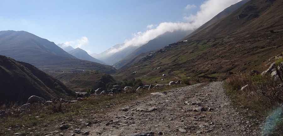
The road to the plateau is totally unpaved. It’s very difficult and runs alongside the Legen Creek. It’s called Verçenik Yolu. It’s very rough and rocky, so a 4x4 vehicle with high clearance is required.
How long is the road to Verçenik Yaylası?
The road to the summit is pretty steep. Starting from Ortayayla, the road is 7.4km (4.59 miles) long. Over this distance, the elevation gain is 582 meters. The average gradient is 7.86%.
What do road users say about the road?
Some users describe the road as dirt and rocky, but manageable if you drive in 1st gear and pay attention to the stones. They point out that the beautiful plateaus maintain their charm partly because of the difficulty in reaching them. There are no facilities on the plateau, so it’s recommended to bring food or picnic materials. The route offers magnificent views, and a few residents—7 or 8 households—live and work on the plateau. While not every vehicle can get there, and the road is long with bad sections, users agree that this is one of the highest and most impressive plateaus in the region.
Pic: muhammet sayın