The Wild Road to the top of Mt. Uludağ
Mt. Uludağ is a high mountain peak at an elevation of 1,905m (6,250 ft) above sea level, located in Bursa Province of Turkey. It’s the highest mountain of the Marmara region.
Where is Mt. Uludağ?
The mountain is located in the Marmara Region, in the northwestern part of the country.
Why is Mt. Uludağ famous?
The summit hosts a popular center for winter sports as well as a National Park and is known in mythology as the place where the gods watched the Trojan War. Summer activities, such as trekking and camping, are also popular. It’s open to tourism all year round and is one of Turkey’s most beautiful epitomes of magnificent nature. The mountain is also known as Mysian Olympus or Mt Olympus, and it is the highest mountain in northwestern Turkey.
Is the road to Mt. Uludağ paved?
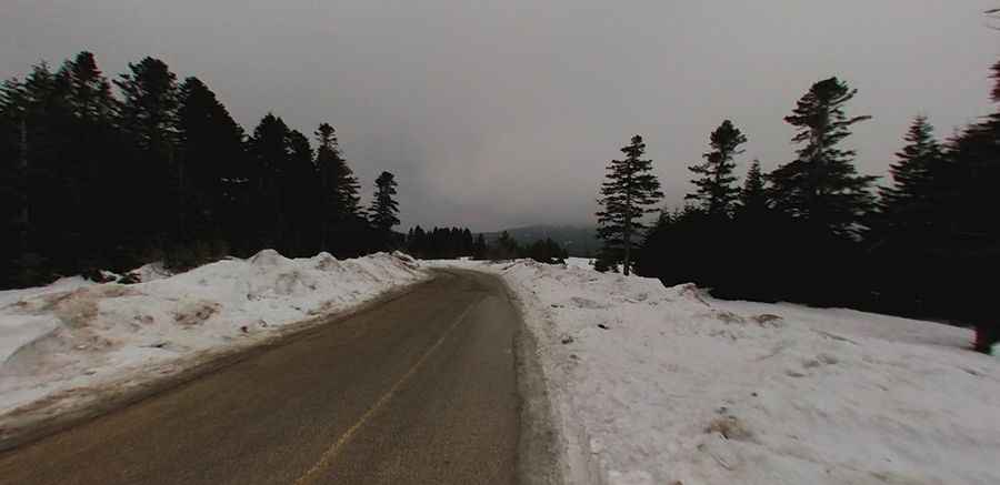
The road to the summit is fully paved and in very good condition but steep in parts. The average gradient is around 6%. Starting from the paved D575 road, the ascent is 10.6 km (6.58 miles) long. Beyond Oteller (the area where all hotels are clustered), a tiny gravel road climbs up to Uludağ-Volfram Mine, at 2,331m (7,647ft) above sea level.
Is the road to Mt. Uludağ open?
The road is typically open all year round, but short-term closures are common in winter due to dangerous weather conditions. In winter, vehicles without tire chains may not be allowed to go further than the national park gate at Karabelen if park authorities decide so (which they usually do on heavily snowing days). Whether a snowy day or not, winter driving rules apply.
Pic: Serkan KÖSEMEK