Driving the Salmankaş Geçidi: Three eras of a Turkish mountain pass
Salmankaş Geçidi is a high mountain pass located on the boundary between the provinces of Gümüşhane and Bayburt in northeastern Turkey. Situated in the rugged Pontic Mountains, this pass has historically served as a vital link for caravans and military routes between the Black Sea coast (Trabzon and Araklı) and Eastern Anatolia. Today, Salmankaş is a rare geographical case where three distinct generations of engineering coexist: an ancient 10km gravel shortcut, a winding 18km paved road, and a modern 4.1km twin-tube tunnel, with elevations ranging from 2,280m to 2,373m depending on the chosen route.
| Road facts: Salmankaş Geçidi | |
|---|---|
| Location | Gümüşhane - Bayburt border, Turkey |
| Max Elevation | 2,373m (Gravel) / 2,280m (Paved) |
| Tunnel Length | 4,150 m (Twin-tube) |
| Historical Significance | Ancient Silk Road route |
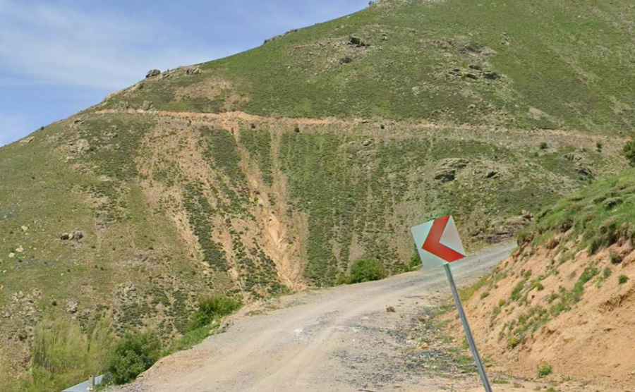
How difficult is the old 10km gravel shortcut of Salmankaş?
The original route over the Salmankaş Pass is a 10-kilometer unpaved track that is strictly reserved for high-clearance vehicles. The road is a relentless series of sharp turns carved into a landscape of loose shale, where a notorious lateral drop-off defines the entire ascent. There are absolutely no safety protections or barriers. This route reaches the highest point of the pass at 2,373 meters. The physical reality of driving here involves managing a vehicle on deep ruts where the lack of traction on the steep ramps makes any steering error potentially fatal. This track was the primary bypass for centuries, but today it remains a mechanical torture test that is often blocked by snow for more than six months a year.
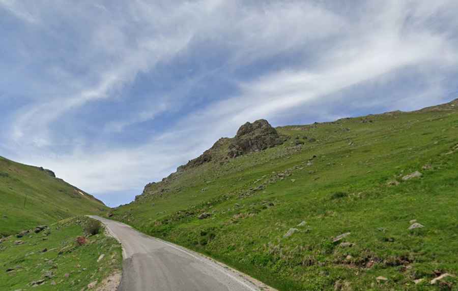
What is the paved 18km mountain road like today?
To avoid the extreme hazards of the original gravel track, an 18-kilometer paved road was constructed to manage the transit across the Pontic Mountains. Although the surface is asphalted, the road is exceptionally narrow and features a continuous sequence of hairpins that follow the steep incline of the Mount Salmankaş slopes. This version of the pass reaches an elevation of 2,280 meters. The logistics of driving this route are complex; you must face oncoming traffic on a lane that is barely wide enough for two small cars. In winter, high-frequency icing and heavy fog make this paved road a high-risk sector where the braking system and tire grip are constantly at their limit.
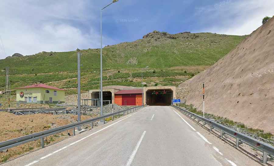
How has the Salmankaş Tunnel changed the crossing?
Opened on December 20, 2019, the Salmankaş Tunnel is a 4,150-meter-long twin-tube engineering project that has fundamentally altered the logistics of the region. Built using the New Austrian Tunnelling method (NATM), it effectively eliminates the need to climb the dangerous upper sections of the pass. The tunnel bypasses the summit entirely, shortening the route by about 16 km. It eliminates the six-month-long traffic blockade caused by harsh climatic conditions, providing a reliable, all-weather link that bypasses the avalanches and deep snow that define the old Silk Road path.
What mechanical prep is needed for the Salmankaş Pass?
If you choose to drive the historical gravel shortcut or the narrow paved road instead of the tunnel, your vehicle must be in top mechanical condition. For the 10km gravel section, verify your 4WD system and tire sidewall integrity; the sharp rocks will destroy standard road tires. If driving the 18km paved route, check your cooling system and brake fluid; the continuous gear changes and steep descents put an immense load on the motor and the pads. Always carry extra fuel and emergency gear, as the weather at 2,300 meters can shift from clear skies to a heavy snowstorm in minutes. Even with the modern tunnel open, the mountain environment of Salmankaş demands total respect for the physical reality of high-altitude driving.
Road suggested by: jorge manuel gómez sánchez