Driving the deadly road to Pirinkayalar Pass
Pirin Kayalar Geçidi is a mountain pass at an elevation of 1,122m (3,681ft) above sea level, located in the Erzurum province of eastern Anatolia, in Turkey.
Where is Pirin Kayalar Geçidi?
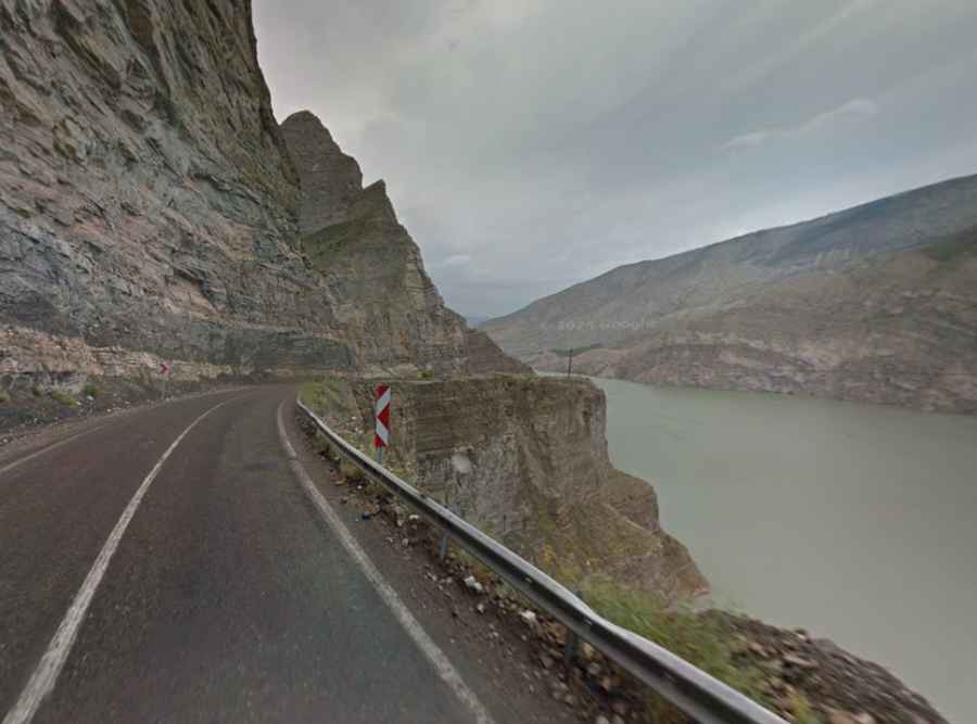
The pass is located in the Uzundere district, on the northeastern part of the country, on the western side of Lake Tortum.
How long is Pirin Kayalar Geçidi?
The road through the summit is entirely paved. It’s called Erzurum-Artvin highway, connecting Erzurum in Eastern Anatolia to Artvin in the Eastern Black Sea via the Uzundere district. It’s 3.3 km (2.05 miles) long.
How dangerous is Pirin Kayalar Geçidi?
The road to the summit is popularly known as the Road of Death due to the many fatal accidents that have occurred here. The road, heavily used by trucks, is a nightmare for heavy-tonnage vehicle drivers, especially in winter due to its sharp and steep bends. It features a high risk of landslides.
What’s the Pirin Kayalar Tunnel?
Due to the dangerous nature of the road, on Wednesday, December 29, 2021, the Pirin Kayalar Tunnel was opened to traffic to bypass the most challenging part of the route. The 2,246-meter tunnel, known as Pirin Kayalar Tuneli, was built to relieve traffic on the highway, which is sometimes closed due to heavy snowfall in winter, and to further stimulate tourism in the region.
Is Pirin Kayalar Geçidi worth it?
Although it may be challenging for drivers, the road offers a beautiful view of Tortum Lake for passengers.