All About the Road to Tanin Gecidi
Tanin Geçidi is a high mountain pass at an elevation of 2,230m (7,316ft) above sea level, located in Şırnak Province, in the Southeastern Anatolia Region of Turkey.
Is the Road to Tanin Geçidi paved?
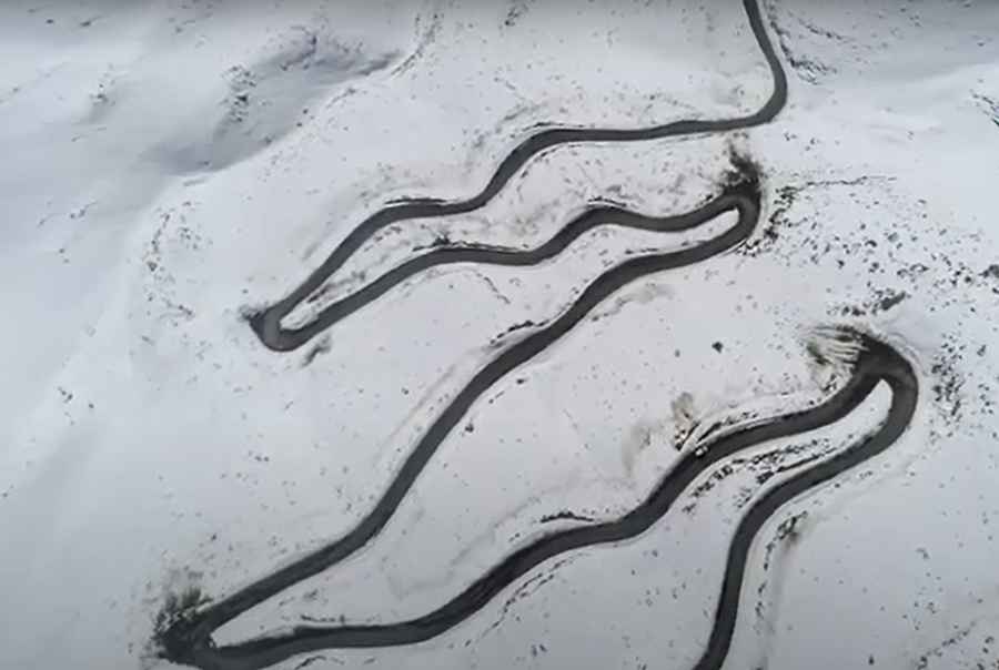
Located to the south of Lake Van, near the border with Iraq, the winding road to the summit, also known as Tanin Tanin Geçidi, was recently paved. It’s an extremely challenging drive, with steep parts and sharp turns, with around 34 hairpin turns.
How long is the Road to Tanin Geçidi?
This road is usually impassable in winters. Due to its location, the summit receives heavy snowfalls. The road is 23.4 km (14.54 miles) long, running west-east from Özelli to Uzungeçit.
The real challenge of Tanin Geçidi
To the south of the pass, a challenging unpaved road climbs up to the real summit, ending at 2,432m (7,979ft). The road is not easy, and a 4x4 vehicle is required. The ascent is 1.5 km long, and the elevation gain is 202m. Over this distance, the average gradient is a brutal 13.46%.
Road suggested by: Hugh Wilson
Pic&video: //www.youtube.com/@ihacomtr">İhlas Haber Ajansı