Driving the high 4x4 road to Hakkari Dağları
Hakkari Dağları is a massive mountain pass reaching an elevation of 3,340 meters (10,958 ft) above sea level in the Hakkâri Province of southeastern Turkey. This is one of the highest mountain roads in Turkey and represents a true frontier for off-road driving. The road to the summit is a raw, unpaved track that climbs through the jagged Cilo Mountains. Driving here means leaving any hope of paved comfort behind; you are entering a high-altitude zone where the thin air and the unstable dirt surface demand a prepared vehicle and a driver who knows how to handle extreme inclines on a shifting floor.
| Road facts: Hakkari Dağları | |
|---|---|
| Location | Hakkâri Province, Southeastern Turkey |
| Elevation | 3,340m (10,958ft) |
| Length | 11.7 km (7.2 miles) |
| Average Gradient | 8.88% |
Where is Hakkari Dağları located?
The pass is located in the most southeastern corner of Turkey, within the rugged landscapes of the Hakkâri Province. This is a high-mountain territory near the borders of Iran and Iraq, where the geography is defined by the high-frequency peaks of the Taurus range. To reach the summit, you start from the village of Ördekli and head deep into a region where the road is the only sign of human presence. This is a remote sector where you are completely isolated from the nearest mechanical workshop or service station, surrounded only by barren rock and high-alpine ridges.
Is the road to Hakkari Dağları unpaved?
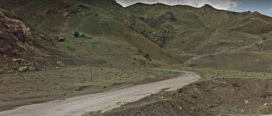
The road to the summit is entirely unpaved and is in a constant state of decay. As seen in the local terrain, the surface is a mix of fine dust, loose gravel, and exposed rocks. A 4x4 vehicle is mandatory here; you will face sections where the lack of traction makes it difficult to maintain momentum on the steeper ramps. The track is often narrow and features unprotected drop-offs that require absolute focus. Any significant rainfall or late-season snowmelt can turn the dirt sections into a slippery trap, making the ascent impossible for two-wheel-drive vehicles.
How long is the road to Hakkari Dağları?
Starting from Ördekli, the climb to the summit covers 11.7 kilometers (7.2 miles). Over this distance, the elevation gain is a staggering 1,039 meters. This results in an average gradient of 8.88%. In reality, the climb is much more aggressive than the average suggests, with sustained ramps that hit much higher percentages than 7%. These steep sections will force your engine to work at its thermal limits. At over 3,300 meters, your motor will lose about 35% of its power, meaning you will need low range and a steady foot on the pedal to clear the most difficult switchbacks.
Is the road to Hakkari Dağları open year-round?
No. Due to its extreme altitude, the pass is usually impassable from late October through late June or early July. The area is subject to heavy snowfalls that can bury the track under meters of snow for the majority of the year. Even in the middle of summer, the weather is unpredictable; sudden storms can drop the temperature rapidly and visibility can vanish in minutes. The "window" for safe travel is narrow, and you should always check the snowmelt status before committing your vehicle to such a remote high-altitude climb.
What mechanical prep is needed for the Hakkari Dağları climb?
Before leaving Ördekli, verify that your cooling system and radiator are 100% reliable. Climbing over 1,000 vertical meters at slow speeds on an 8.88% gradient is a torture test for any motor, especially in the thin air where cooling is less efficient. Check your tire sidewalls for any damage; the sharp, fragmented stones of the Hakkâri mountains can slice through standard highway rubber in seconds. On the descent, do not ride your brakes. Use engine braking in low gear to hold the vehicle back and keep your pads fresh for emergencies. Carry at least 20 liters of extra water, a full-sized spare, and recovery gear, as a breakdown at 3,340 meters in this part of Turkey is a survival situation.