How to drive the unpaved road to Pirreşit Dağı in Van?
Pirreşit Dağı is a high mountain peak at an elevation of 3.086m (10,124ft) above sea level, located in the Muradiye district of Turkey. It’s one of the highest roads of the country.
Where is Pirreşit Dağı?
The peak is located in Van province, in the eastern part of the country, near the border with Iran.
What’s at the summit of Pirreşit Dağı?
The summit hosts NATO military facilities.
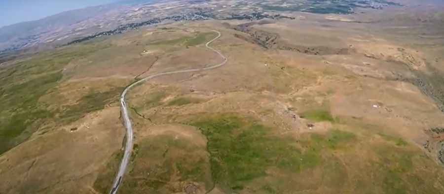
Is the road to Pirreşit Dağı unpaved?
The road to the summit is totally unpaved but navigable by most passenger vehicles.
How long is the road to Pirreşit Dağı?
The road to the summit is very steep, hitting a 12% of maximum gradient through some of the ramps with 8 hairpin turns. Starting at Aşağıakçagül, the ascent is 11.1km (6.89 miles) long. Over this distance the elevation gain is 989 meters. The average gradient is 8.90%.
Is the road to Pirreşit Dağı open year-round?
This road is usually impassable from late October through late June or early July (depending on snow).
Pic&video: Selim Bilen