How To Travel The Paved Road to Ulubeyli Geçidi
Ulubeyli Geçidi is a high mountain pass at an elevation of 2,475m (8,120ft) above sea level located in the Eastern Anatolia Region, in Turkey.
| Road facts: Ulubeyli Geçidi | |
|---|---|
| Location | Bitlis and Van provinces (Turkey) |
| Elevation | 2,475 m (8,120 ft) |
| Length | 36.5 km (22 miles) |
| Surface | Paved |
Where is Ulubeyli Geçidi located?
The pass is located on the boundary between Bitlis and Van provinces, in the southeastern part of the country. At the summit there's a military installation knwown as Ulubeyli Jandarma Karakolu.
Why was the road through Ulubeyli Geçidi paved?
When the Karabet Pass is blocked (it frequently closes for weeks or months due to heavy snow and severe avalanche risks), the Ulubeyli Pass becomes the only bypass to prevent Bahçesaray from being completely cut off. Even though this detour forces a 250-kilometer journey to reach Van, the Ulubeyli Pass sits at a lower altitude (2,475 m) and is much safer from avalanches. This critical role as a winter lifeline is why the local authorities finally paved the road in the early 2020s.
Is the road through Ulubeyli Geçidi difficult to drive?
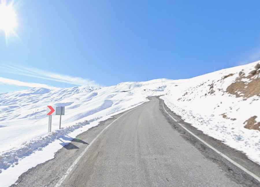
The road to the summit is totally paved since the 2020s, though it doesn’t mean it’s an easy drive. The road is steep and narrow in many parts, and faces massive unprotected drop-offs. Many drivers refuse to take it due to the severe risk of a fall.
How long is the road through Ulubeyli Geçidi?
The road through the pass is 36.5 km (22 miles) long, running west-east from Soğuksu (Bitlis province) to Cevizlibelen (Van province).
Is the road through Ulubeyli Geçidi open in winter?
Set high in the Kavuşşahap mountains of the Southeastern Taurus, the road is open year-round. But it is the most mountainous, highest, and coldest region in the country and heavy snowfalls block often the road in winters.