Driving the 28 hairpins to Singer Dağı in Eastern Turkey
Singer Dağı is a high mountain pass reaching an elevation of 2,843m (9,327ft) above sea level, located in the rugged Bitlis-Van border region of Eastern Turkey. The route, situated south of Lake Van, is a technical high-altitude track characterized by extreme gradients and 28 tight hairpin turns.
| Road facts: Singer Dağı (Kuskunkıran) | |
|---|---|
| Location | Bitlis / Van Border (Turkey) |
| Elevation | 2,843 m (9,327 ft) |
| Length | 23 km (14.3 miles) |
| Max Gradient | 18% |
| Hairpin Turns | 28 Switchbacks |
| Surface | Unpaved / Loose scree and dirt |
How difficult is the road to Singer Dağı?
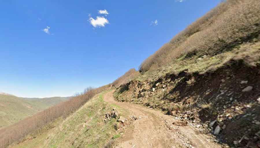
The 23 km (14.3 miles) corridor between Koruklu and Kolludere is a high-altitude transit through a dry, rocky landscape. Technically, the ascent involves a concentrated sector of 28 sharp hairpin turns with ramps hitting an 18% gradient. Logistically, the track is exceptionally narrow and lacks any form of stabilization or safety barriers. As seen in the most exposed sections, the roadbed is composed of loose stones and dirt, requiring a high-clearance 4x4 with low-range gearing to maintain traction and manage engine braking during the steep descent.
What are the driving hazards on the Singer Dağı pass?
The primary technical hazard on Singer Dağı is the geological instability of the mountain slopes. The 23 km route is prone to deep ruts caused by runoff and lateral erosion that compromises the outer edge of the track. Logistically, the "tippy" nature of the road requires sustained concentration to avoid sliding on the loose scree. Technically, the 2,843m elevation affects engine cooling and power output, making the 18% gradients a significant mechanical stress test. Total self-sufficiency is mandatory, as the remote sector between Bitlis and Van offers zero recovery infrastructure.
Is the road to Singer Dağı open in winter?
Due to its summit altitude of 9,327ft in Eastern Anatolia, Singer Dağı remains impassable due to heavy snowpack for most of the year. Logistically, the pass is typically closed from late October until late June. Technically, even during the summer operating window (July to September), rapid weather shifts can turn the 23 km dirt track into a mud-traction hazard. Before attempting the drive, it is essential to carry extra fuel, water, and tools, as the isolation of the Bitlis/Van border region means help is unavailable along the entire high-altitude transit.