Driving the dangerous cliff road through Çakıt Vadisi
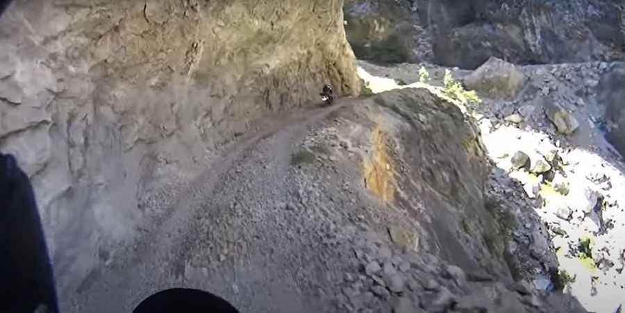
The cliff road through Çakıt Vadisi is an extreme unpaved route situated on the provincial boundary between Adana and Mersin in southern Turkey. The track runs along a narrow shelf cut into the limestone walls of the Taurus Mountains.
| Road facts: Çakıt Vadisi | |
|---|---|
| Location | Adana / Mersin Border, Turkey |
| Length | 24.47 km (15.16 miles) |
| Surface | Unpaved / Raw Rock & Shifting Scree |
| Status | Impassable due to major rockfall |
When was the Çakıt Vadisi road built?
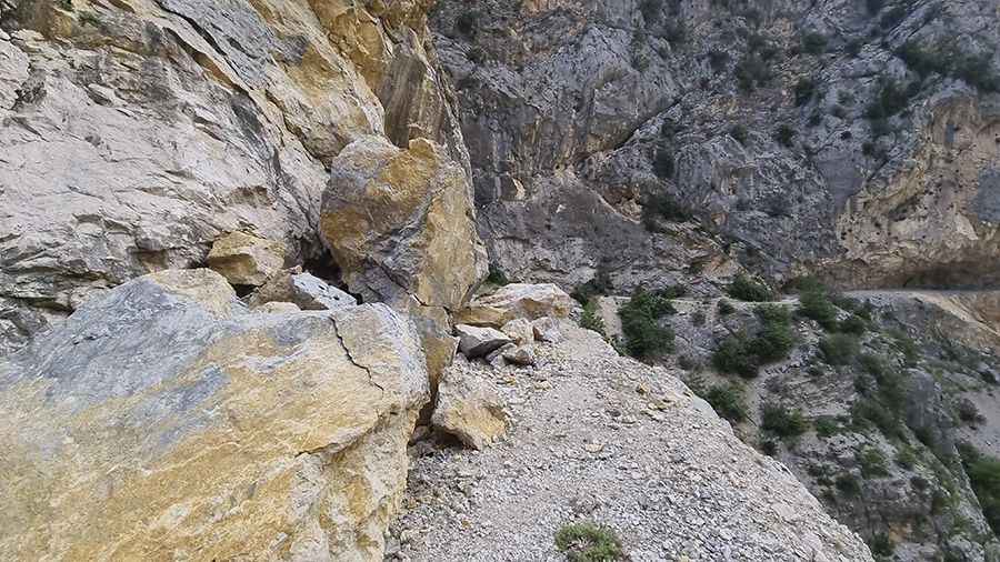
The road was constructed during the 1910s and 1920s by German engineers. It was built as a service track to transport laborers, equipment, and heavy materials for the construction of the Baghdad-Hijaz railway line. Workers used dynamite to blast this narrow shelf directly into the vertical canyon walls to access the construction sites of the 12 railway tunnels in the Taurus mountain range.
How long is the road from Belemedik to Kiralan?
The unpaved track is 24.47 km (15.16 miles) long, linking the settlement of Belemedik with Kiralan. The lane is suspended hundreds of meters above the Çakıtsuyu River bed. The driving line is narrow, offering single-car clearance with zero passing bays, concrete walls, or steel safety barriers against the drop into the river canyon.
Why is the Çakıt Vadisi road currently impassable?
A massive mountain collapse has completely blocked the central sector of the route. Enormous boulders and limestone slabs have crushed the roadbed, making is impassable. The blockage spans the entire width of the track, preventing cars or motorcycles from passing. Due to the narrowness of the ledge, drivers who encounter the landslide must back up for kilometers on the cliff edge to find space to turn the vehicle around.
What are the risks in the Çakıt Valley canyon?
The track bed consists of raw, unlined limestone and sharp shale fragments that cut standard tire sidewalls. Driving the open sections requires a four-wheel-drive vehicle with high ground clearance and reinforced off-road tires. The slow crawling speed through the canyon increases engine operating temperatures, putting stress on cooling fans. The steep rock walls block cellular network signals, preventing emergency communication or vehicle recovery assistance inside the valley.
Road suggested by: Janka
Pic: murat can Özkul