Conquering Theodul Pass on the Swiss-Italian Border
Theodulpass is an international high mountain peak at an elevation of 3.336m (10,944ft) above sea level, located on the border of Switzerland and Italy. It's one of the highest roads of Europe.
Where is Theodulpass?
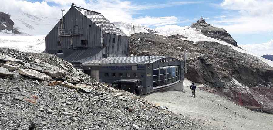
The pass, also known as Colle del Teodulo, Col de Saint-Théodule and Theoduljoch, links the southern Switzerland’s Valais canton and the Valle d'Aosta region of northwest Italy. Rifugio del Teodulo (hut), built in 1920, is located just above the pass.
Can you drive to Theodulpass?
The runway to the top -a chairlift access trail- is totally unpaved. It was closed for public motorized traffic in 2009, but as a cyclist you still may reach the top, only in best weather conditions in midsummer. Before, it was the highest point in the Alps accessible by motor vehicle. It's one of the highest roads of the country.
How long is the road to Theodulpass?
Starting at Breuil-Cervinia (Aosta Valley), the ascent is 10.5 km (6.52 miles) long. Over this distance the elevation gain is 1.308 meters. The average gradient is 12.45%.
Is Theodulpass steep?
The road to the summit is brutally steep, hitting a 30% of maximum gradient through some of the ramps. The slope is very steep, consists of loose stones and becomes even steeper and rocky in the upper part.
Is Theodulpass open?
Set high on the eastern Pennine Alps, this trail can be done only a very narrow time-frame in the summer (end of August).
Pic: Ingrid Sharon Piccolini