Pas d’Arpilles: Driving the extreme 9.8% chairlift road in Valais
Reaching an elevation of 2,568m (8,425ft) above sea level, Pas d’Arpilles is a high mountain peak located in the heart of the Swiss Alps, within the canton of Valais. Situated in the Pennine Alps, this summit is a technical challenge reserved for high-clearance vehicles, serving as a vital access route for the mountain infrastructure of the Crans-Montana region.
| Road facts: Pas d’Arpilles | |
|---|---|
| Location | Valais, Switzerland (Pennine Alps) |
| Elevation | 2,568 m (8,425 ft) |
| Length | 9.2 km (5.7 miles) |
| Elevation Gain | 903 m |
| Average Gradient | 9.81% |
Where is Pas d’Arpilles?
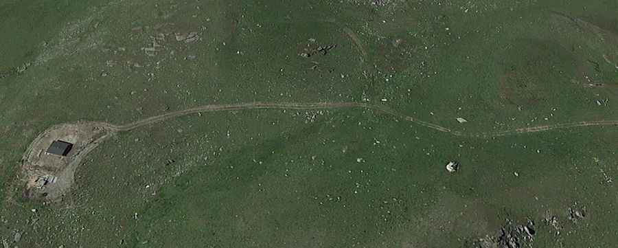
The peak is located in the high mountains of Valais, overlooking the Rhone Valley. The road to the summit is primarily a chairlift access road, used by service vehicles to maintain the ski resort infrastructure. From the top, the geography offers a staggering view of the Swiss giants, including distant glimpses of the Matterhorn and the Weisshorn. The isolation at 2,500 meters is absolute, and the peak is exposed to the full force of the Alpine elements, where high winds blow all year long.
Is the road to Pas d’Arpilles unpaved?
Yes, the road to the summit is totally unpaved and ranks among the most technical tracks in the area. The slope is very steep and the surface consists of loose stones that offer very little traction. As you climb higher, the trail becomes even steeper and more rocky, especially in the upper part where the track narrows to navigate the limestone crags. This is a route for experienced off-roaders only; the lack of safety barriers combined with the loose debris makes every hairpin a high-stakes maneuver.
How long is the road to Pas d’Arpilles?
Starting from Flanmayens, the road to the summit is 9.2 km (5.7 miles) long. Over this distance, the track overcomes a massive elevation gain of 903 meters. This results in a brutal average gradient of 9.81%, with several ramps exceeding 12%. The drive features 14 sharp hairpin turns that are notoriously tight. The sheer verticality of the 9.8% average means your vehicle's cooling system and brakes will be under extreme stress throughout the entire climb.
When is the best time to drive to Pas d’Arpilles?
Due to its extreme altitude, this trail can be done only within a very narrow time-frame, typically at the end of August. Even in the height of summer, you can be confronted with sudden snowy days that turn the rocky track into an impassable trap. In winter, temperatures here are brutally cold and the road is completely buried under meters of snow, serving only as part of the ski runs. Always check the weather forecast for the Valais region and ensure your vehicle is equipped for rapid Alpine changes, as the strong winds at the summit can cause temperatures to drop well below freezing in minutes.