Lago dei Cavagnöö: Driving the Isolated Cableway-Accessed Road in Ticino
Lago dei Cavagnöö is a high-altitude water reservoir situated at an elevation of 2,352 meters (7,716 ft) above sea level in the Maggia Valley of the Ticino canton, Switzerland. The asphalted road running to the reservoir is completely isolated from the Swiss public highway network, forming a disconnected mountain track system.
| Road facts: Lago dei Cavagnöö | |
|---|---|
| Location | Maggia Valley, Ticino, Switzerland |
| Elevation | 2,352 m (7,716 ft) |
| Surface | Paved / Narrow Asphalt |
| Access | Restricted (Hydroelectric service vehicles only) |
| Dam Height | 111 meters (364 ft) / Completed in 1968 |
How do vehicles reach the isolated road to Lago dei Cavagnöö?
The asphalt lanes at Lago dei Cavagnöö cannot be reached by driving from the valley floor. Regular public road access ends downstream at San Carlo in Val Bavona. To get trucks, vans, and utility vehicles onto this high-altitude track, the machinery must be loaded onto a heavy-duty industrial cableway that hoists them up to the Robièi plateau. From this upper landing terminal, a private, fully paved road network links the various mountain dams including Robièi, Lago Bianco, and Cavagnöö.
Is the road to Lago dei Cavagnöö open to public cars?
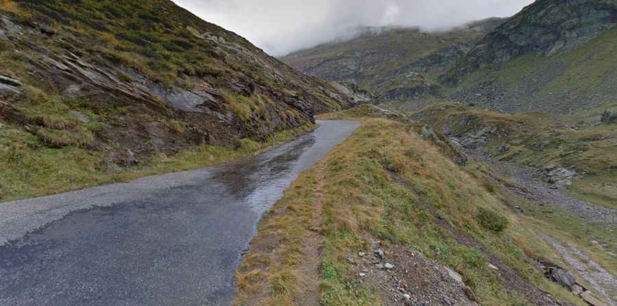
Private motorized traffic is strictly prohibited on the entire network. The road is owned and monitored by Maggia Kraftwerke AG solely for servicing the 111-meter-high arch dam and checking the underground water galleries. The asphalt track is exceptionally narrow, measuring under 3 meters in width. It features tight curves and unlit, rough-cut rock tunnels through the granite walls, leaving no room for vehicles to pass each other outside of designated utility bays.
What are the asphalt hazards at 2,352 meters?
The high-altitude shelf is exposed to extreme sub-zero winter temperatures, which causes severe frost heaves, seasonal tarmac cracking, and deep potholes along the single lane. The track runs directly beneath the steep rock slopes of the Basodino glacier, meaning sharp granite rockfalls regularly hit the asphalt surface. The path has zero steel guardrails or concrete walls, leaving the outer tire tracks completely exposed to shear drops into the mountain basins.
When does winter snow close the Cavagnöö dam road?
Heavy alpine snow blocks the high-altitude road from October until late June. Because the track is purely for hydroelectric utility access, no snowplow clearing occurs during the winter months, allowing snowdrifts to pack several meters deep across the dam wall flanks. During the summer opening, dense clouds and high-altitude fog roll off the glacier slopes instantly, dropping driving visibility down to less than two meters inside the unlit tunnel entrances.