How to drive the steep 4x4 service road to Bettmerhorn in the Bernese Alps?
Bettmerhorn is a high mountain peak at an elevation of 2,492 meters (8,175 ft) above sea level, located in the Raron district of Valais, Switzerland. The access to the summit area is restricted to a steep, unpaved service track used exclusively for ski lift maintenance and mountain restaurant supply vehicles.
| Road facts: Bettmerhorn Service Track | |
|---|---|
| Location | Valais, Bernese Alps, Switzerland |
| Elevation | 2,492 m (8,175 ft) |
| Length | 2 km (1.24 miles) from Bettmeralp |
| Average Gradient | 14.25% |
| Surface | Unpaved (Loose alpine gravel and granite rocks) |
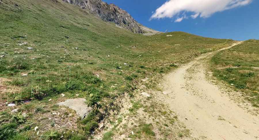
How steep is the track from Bettmeralp to Bettmerhorn?
Starting from the car-free resort village of Bettmeralp, the track climbs 285 vertical meters over a distance of just 2 km. This creates a brutal average gradient of 14.25%, with several inner curves on the switchbacks spiking well above this figure. The roadbed consists of loose granite gravel and coarse rocks, requiring a heavy-duty 4x4 with a low-range gearbox to crawl up the ramps without spinning the tires and digging holes into the track foundation.
What are the driving hazards near the Great Aletsch Glacier?
The track runs right above the edge of the Great Aletsch Glacier, where sudden alpine weather shifts dictate road conditions. Thick walls of fog roll off the ice sheet instantly, dropping driving visibility down to zero on narrow ledges that completely lack safety barriers or steel guardrails. Due to the high altitude, wheels cross patches of permafrost mud that stay slick even during mid-summer afternoons, causing vehicles to slide on the unpaved mountain shoulders.
How dangerous is the downhill descent back to Bettmeralp?
The return drive requires dropping down the same 14.25% slope via tight, unbanked switchbacks. Relying on the foot brake will smoke the brake pads and boil the fluid before completing the first kilometer, forcing drivers to shift into first gear in low-range to let the engine control the speed. The track is littered with sharp granitic rocks that slice open tire sidewalls, and because Bettmeralp is completely closed to regular car traffic, commercial tow trucks are barred from entering the zone to assist broken-down vehicles.
When does snow close the Bettmerhorn mountain track?
Heavy winter snowfall typically buries the track from late September until well into July. The path is never plowed for wheeled vehicles, as the entire mountain sector transforms into active ski slopes during the winter months. During the brief summer opening, heavy rainstorms regularly wash out the loose gravel surface, cutting deep transverse trenches across the path that require high ground clearance to cross without ripping off front bumpers or smashing oil pans.
Pic: Sam Borman