Pas du Boeuf
Pas du Boeuf is a high mountain peak at an elevation of 2.685m (8,809ft) above the sea level, located in southern Switzerland’s Valais canton.
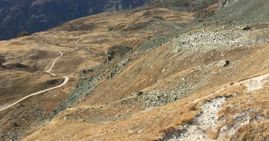
Located within the Swiss Pennine Alps, the road to the summit is rocky and gravel. It’s a chairlift access trail. The slope is very steep, consists of loose stones and becomes even steeper and rocky in the upper part. The wind is usually quite strong at mountain areas. High winds blow here all year long. Even in summer you can confront with snowy days. Temperatures here in the winter are brutally cold. This trail can be done only a very narrow time-frame in the summer (end of August). The steep is over than 30%. Avoid driving in this area if unpaved mountain roads aren't your strong point.
Pic: Joachim Segui