How to drive the extreme chairlift access road to Greitspitz?
Greitspitz, also known as Greitspitze, is a high mountain peak at an elevation of 2,876 meters (9,435 ft) above sea level, located on the international border between Switzerland (Grisons canton) and Austria (Tyrol). Positioned within the Samnaun and Ischgl ski domains, the summit is reached via an extreme unpaved mountain track used for chairlift and ski resort infrastructure maintenance.
| Road facts: Greitspitz | |
|---|---|
| Location | Switzerland (Samnaun) - Austria (Ischgl) |
| Elevation | 2,876 m (9,435 ft) |
| Max Gradient | 20% |
| Surface | Unpaved (Loose stones and heavy rock blocks) |
Where is the mountain track to Greitspitz?
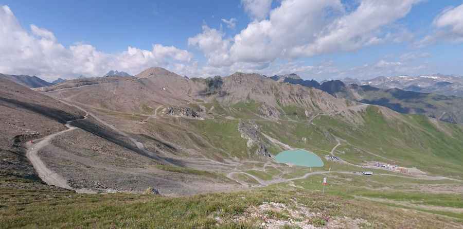
The unpaved service road climbs the steep alpine ridges right on the frontier line between the Austrian Tyrol and the Swiss Silvretta Alps. The track runs directly through the middle of the active ski slopes, positioning it among the highest mountain roads of Switzerland. The route terminates blindly at the station structures on the rocky summit crest.
How difficult is the climb to Greitspitze?
The road is entirely unpaved, featuring a highly unstable surface of jagged stones, loose shale, and bare mountain bedrock. The ascent is exceptionally steep, with maximum gradients exceeding 20% on the final approach ramps. A high-clearance 4x4 vehicle equipped with a low-range gearbox is required to prevent continuous wheel spin on the loose debris, as the lack of oxygen at nearly 2,900 meters reduces engine performance significantly.
Is the Greitspitz road open year-round?
Due to its extreme altitude, the track is buried under deep snow and ice for most of the year, serving exclusively as active ski runs. The path is cleared and accessible only for a short summer window between July and September. The single-lane road lacks guardrails or side safety barriers against the steep vertical drops of the valley, and sudden summer afternoon storms can wash out the trackbed or cover the upper ridge in thick fog within minutes.
Pic: Miko Saastamoinen