How to drive the steep 14.24% ascent to Col de Balme?
The Col de Balme is an international high mountain pass at an elevation of 2,209m (7,247ft) above sea level, situated on the border between France (Haute-Savoie) and Switzerland (Valais). The French side is accessed via a narrow and extremely steep gravel track from Vallorcine, while the Swiss side consists exclusively of a walking path toward Trient. Logistically, the summit is a dead-end for motor vehicles, and the ascent requires a high-performance 4x4 to manage the sustained vertical climb.
| Road facts: Col de Balme | |
|---|---|
| Location | France (Vallorcine) - Switzerland Border |
| Elevation | 2,209m (7,247ft) |
| Length | 6.6 km (from Vallorcine) |
| Average Gradient | 14.24% |
| Elevation Gain | 940 m |
What are the mechanical challenges of the Col de Balme ascent?
Starting from Vallorcine, the road to the summit covers 6.6 km with a massive elevation gain of 940 meters. This results in an average gradient of 14.24%, which is extremely high for a gravel surface. Driving this sector requires constant use of low-range gearing to maintain the necessary torque without overheating the engine. The track is narrow and features loose stones that can compromise traction, especially on the inner radius of the steeper turns. It is a technical requirement to monitor coolant temperatures closely, as the high-load climb at over 2,000 meters significantly reduces cooling efficiency.
How to manage the technical descent from Col de Balme?
The 6.6 km descent back to Vallorcine is a major hazard for the vehicle's braking system. With a sustained 14% decline on gravel, relying solely on service brakes will lead to brake fade within the first few kilometers. Drivers must utilize engine braking by staying in a low gear. Logistically, the summit is marked by a stone alpine restaurant that provides shelter, but there are no mechanical services or turnaround areas for large vehicles. The track is only accessible from late June to mid-September; outside of this window, snow accumulation makes the steep gradients impassable.
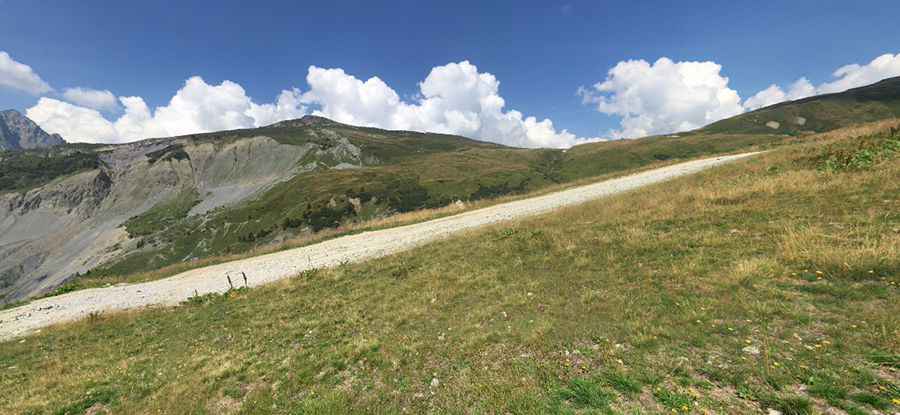
What is the road condition on the Col de Balme border track?
The surface on the French side is a typical alpine "two-track" consisting of compacted earth and loose gravel. Visual inspection shows that the track is highly exposed to weather-induced erosion. Heavy rain can quickly form transverse gullies and wash away the finer binding material, leaving sharp rocks exposed that can damage tire sidewalls. High ground clearance is mandatory to avoid striking the undercarriage on the high center of the track. Before attempting the transit, verify the weather forecast for the Haute-Savoie region, as sudden storms can turn the steep slopes into a high-risk skid zone with zero lateral grip.
Vehicle requirements for the Vallorcine to Col de Balme route
A specialized 4x4 vehicle in top mechanical condition is the only option for Col de Balme. Check that your tires have sufficient tread depth to bite into the loose gravel on 14% inclines. It is a technical necessity to carry a full-size spare tire, a jack capable of working on uneven terrain, and basic recovery equipment. Logistically, ensure your fuel tank is full before leaving the Argentière area, as the extreme gradient will cause fuel consumption to double compared to flat-ground driving. Due to the isolation of the border ridge, a mechanical failure requires complex recovery logistics that are often restricted by the narrowness of the path.
Pic: Riley Hope