The curvy road to Albula Pass is an absolute must
Passo dell'Albula is a high mountain pass at an elevation of 2,306m (7,565ft) above sea level, located in the canton of Graubünden, in Switzerland. The pass is open from June to October.
Where is Albula Pass?
Located in the eastern part of the country, the pass connects the Albula Region with the Maloja Region. It’s one of the three paved road passes connecting Engadin with the northern Grisons, the other two being the Julier Pass and the Fluela Pass.
When was the Albula Pass built?
The road traversing the pass was constructed in 1865, and at that time, it was the most important north-south connection in Graubünden. In past centuries, it was a key alpine pass between Lombardy and Austria. Since 1903, a train connects both valleys at a height of 1,823m through a 5.9km-long tunnel. It was already being used as a mule trail back in prehistoric times, and the Romans used this route for trade.
How long is Albula Pass?
The road to the summit, also known as Pass d'Alvra, Pass da l'Alvra, and Albulapass, is totally paved. It’s 39.3 km (24.41 miles) long, running west-east from Albula/Alvra to La Punt Chamues-ch (formerly known as Ponte-Campovasto).
Is Albula Pass challenging?
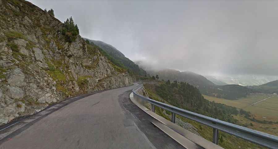
The road to the summit is very steep, hitting a 15% maximum gradient through some of the ramps. This is a very varied pass road, with trees, rocks, hairpins, and sweepers. This pass currently has very little traffic because cars and trucks prefer Julier Pass, which is normally kept open even during the winter. It has some very narrow passages, which means that even today it is best to take your time and enjoy the ride. Sometimes the wind blows very hard from the top, so beware.
Is Albula Pass open?
Set high in the Albula Range of the Alps, this road is seasonally closed and usually impassable from November through April.
How long does it take to drive Albula Pass?
To drive the road without stopping will take most people between 50 and 60 minutes. However, due to its natural beauty, the drive will take longer. On the summit of the pass is a hospice.