An iconic Swiss road to Glaubenbielen Pass
Glaubenbielen Pass is a high mountain pass at an elevation of 1,615 meters (5,298 feet) above sea level, located in the Canton of Obwalden, in Switzerland.
Where is Glaubenbielen Pass?
The pass, also known as Glaubenbühl, is located in the central part of the country, near the Lucerne canton border.
When was the road through Glaubenbielen Pass built?
The fairly narrow road over the pass was built by the Swiss military and was finished just after WW2.
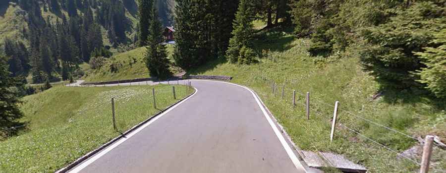
Is Glaubenbielen Pass paved?
The road to the summit is fully paved. It’s called Panoramastrasse. This route has a generally good surface. It’s pretty narrow and steep, with a maximum grade of 12 percent (running along the northern slope of the Giswilerstock) through some of the ramps. Due to its narrowness in parts, there are large chances you'll get stuck behind a slow driver.
How long is Glaubenbielen Pass?
The pass is 29.3 km (18.20 miles) long, running from Giswil (a municipality in the canton of Obwalden) to Flühli (a municipality in the district of Entlebuch in the canton of Lucerne).
Is Glaubenbielen Pass worth the drive?
Tucked away in the Emmental Alps, the drive provides great views of the Bernese Alps. It offers spectacular views of Pilatus and the Stanserhorn when traveling towards Giswil, and of the Brienzer Rothorn massif when traveling towards Flühli.
How steep is Glaubenbielen Pass?
The pass has been featured in the Tour de Suisse race. There are 2 routes to reach the summit. Starting from Giswil, the ascent is 13.4 km long. Over this distance, the elevation gain is 1,126 meters. The average gradient is 8.4%. Starting from Flühli, the ascent is 15.6 km long. Over this distance, the elevation gain is 728 meters. The average gradient is 4.7%.