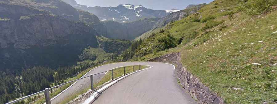
Driving the 136 curves of Klausen Pass in the Swiss Alps
Klausen Pass (Klausenpass) is a high mountain pass at an elevation of 1.956m (6,417ft) above sea level, located in Switzerland. It’s said to have 136 curves with a difference in altitude of 1.237 meters (bottom to top) to reach the summit.
Where is Klausen Pass?
The pass is located in the central part of the country, straddling Uri and Glarus cantons.
Is the road to Klausen Pass paved?
The road to the summit is totally paved. It’s called Road 17 (Klausenstrasse). Opened in 1948, it’s a pleasant road with a great view and very good surface, well known spot for motor bikers, and cyclists. The first section of the pass road is laid out in historic cobblestone pavement. This is a must drive if you can deal with a very narrow curvy mountain road. Several small tunnels are en route.
How long is the Klausen pass?
The pass is 46.6 km (28.95 miles) long, running east-west from Altdorf (the Swiss canton of Uri) to Linthal (in the municipality of Glarus Süd and canton of Glarus). The pass is the first "major" alpine pass you reach driving south from Zurich, in fact, using the highway you can be at the foot of the pass in a little over 1 hour - it really is a passage directly into the heart of the Alps. The drive never gets too busy. The road is steep in parts, hitting a 9% of maximum gradient.
Is the Klausen Pass open?
Set high in the central Swiss Alps, the road is closed from November to June-July due to the high snowfall on the pass. It is always closed to longer vehicles.
Is Klausen Pass worth it?
To drive the road without stopping will take most people between 1 and 1.5 hours. Serpentine by serpentine the incredibly scenic drive pulls up in front of a beautiful mountain panorama way up the pass summit. The summit hosts a gift shop, a snack bar and a public toilet. At the top of the pass is a historic chapel known as the Bruder-Klaus-Kapelle, built in 1938. The pass is littered with tiny alpine villages.