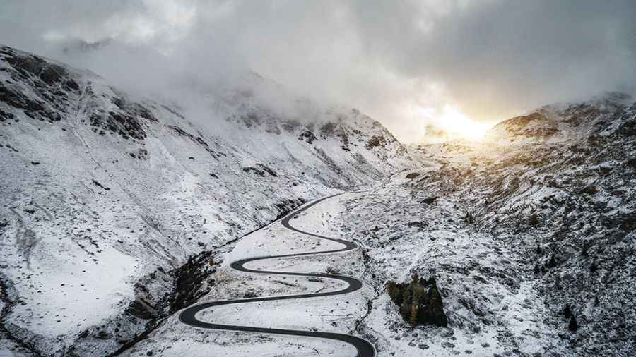
Julier Pass is one of Switzerland’s most scenic roads
Julier Pass is a high mountain pass at an elevation of 2.287m (7,503ft) above sea level, located in the Swiss canton of Graubünden.
Where is Julier Pass?
The pass, also known as Julierpass and Passo del Giulia, is located on the southeastern part of the country, not far from the Italian border. It’s one of the three paved road passes connecting the Engadin with the northern Grisons, the two other being the Fluela Pass and the Albula Pass.
When was the road to Julier Pass built?
The pass was already being used as a mule trail back in prehistoric time and the Romans used this route to trade. The first road through the summit was built between 1820 and 1826 to connect the Engadin valley with the rest of Graubünden. The road was totally paved between 1935 and 1940, being the first alpine traverse with asphalt. In 2009 the road was rebuilt to reduce the number of serpentine turns.
How long is the Julier Pass?
The road to the summit is totally paved. It’s called Route 3. The pass is 34.2 km (21.25 miles) long running from Sursés (in the Albula Region) to Silvaplana (in the Maloja Region).
Is Julier Pass open?
Set high in the Albula Range of the Alps, access to the pass is typically open all year round, with the occasional closure in winters due to dangerous weather conditions. Winter use requires winter tires, as well as snow chains in extremely poor weather.
Is the Julier Pass difficult?
The road to the summit is very steep, hitting a 13% of maximum gradient through some of the ramps. It is easily passable for normal cars and trucks.
How long does it take to drive the Julier Pass?
Plan about 40 minutes to complete the drive without any stop. The road offers stunning Alpine views. On the pass there are still two pillars of a Roman sanctuary.
Image credit: Depositphotos