Driving the iconic paved road to Bernina Pass in the Alps
Passo del Bernina is a high mountain pass at an elevation of 2.332m (7,650ft) above sea level, located in the canton of Graubünden, in Switzerland. It’s one of the most famous Alpine roads of Switzerland.
Where is Bernina Pass?
The pass is located in the eastern part of the country, near the Italian border,
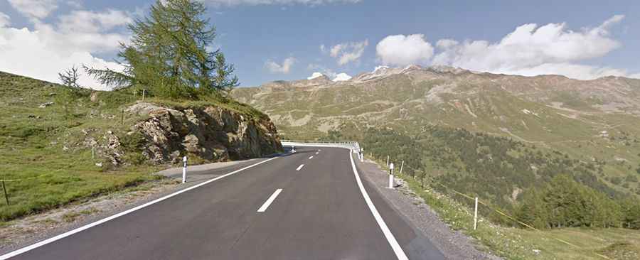
Can you drive through Bernina Pass?
The road to the summit, also known as Berninapass, is fully paved. It's called Hauptstrasse 29.
When was the road to Bernina Pass built?
Construction of the road began in 1842 and was completed in 1865. The pass has been in use since the Middle Ages when people would take their horse-drawn carts filled with goods to the markets to sell. A significant attraction on this mountain is the Bernina Express – the highest long-distance railway in the Alps (reaching 2,253m) – which crosses the road on the north side (twice). For much of its route north of the pass and again south of Poschiavo, the road is closely paralleled by the Bernina railway line. In fact, at a few locations south of Poschiavo, the railway line runs within the carriageway of the road, with road vehicles having to yield to trains.
How long is the Bernina Pass?
The pass is 53.3 km (33.11 miles) long, running north-south from St. Moritz, in Switzerland’s Engadin valley, to Tirano, in the Italian Province of Sondrio. The pass often experiences heavy traffic and numerous tour buses. The road to the summit is quite steep, hitting a 10.4% maximum slope on some of the ramps.
Is Passo del Bernina open?
Set high in the Bernina Range of the Alps, access to the pass has typically been open year-round since 1965, although it sees snow for eight months of the year. Winter weather might prompt short restrictions and closures due to hazardous conditions.
How long does it take to drive Bernina Pass?
The drive offers breathtaking views of Alpine peaks and lakes through some of the country's most picturesque scenery. Driving the road without stopping usually takes between 1 and 1.5 hours. When traveling from northwestern St. Moritz toward Val Poschiavo, visitors will see Lago Bianco - the "White Lake" - on their right for most of the road. At the summit, there are a few restaurants and a hotel.