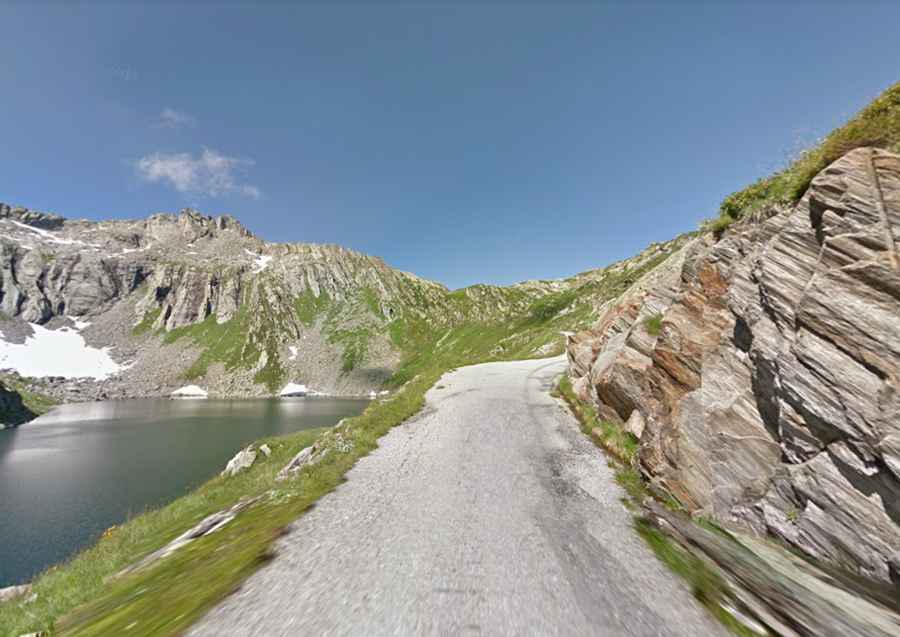
A steep road to Lago del Naret in Ticino
Lago del Narèt is a high mountain reservoir at an elevation of 2,310m (7,578ft) above sea level, located in the district of Vallemaggia in the canton of Ticino in Switzerland.
Is the road to Lago del Narèt in Ticino paved?
Set high in Val Sambuco, the road to the dam is totally paved. It was built in the 1950s.
How long is the road to Lago del Narèt in Ticino?
Starting at Lavizzara, the road to the artificial lake with crystal clear water is 21.9 km (13.60 miles) long. Over this distance, the elevation gain is 1,570 meters. The average gradient is 7.16%.
How steep is the road to Lago del Narèt in Ticino?
While the profile shows a bunch of full kilometres at 10%, 11%, 12%, etc – there are some short stretches much, much steeper, hitting an 18% of the maximum gradient through some of the ramps. The narrow track keeps climbing steeply through a dense forest of evergreens with many hairpin bends. Then, near the top, the road is fantastic but also has a short descent before the dam itself.
Is the road to Lago del Narèt in Ticino worth it?
The drive offers stunning views of Lago del Sambuco and in the top sections, including the dam itself. In the final few kilometres, there are three more small lakes (Lago di Sassolo, Lago Superiore, and Lago Scuro) before reaching Lago di Naret.