How to drive through Col des Montets in the French Alps?
Col des Montets is a mountain pass at an elevation of 1,461m (4,793ft) above sea level, located in the Haute-Savoie department of France.
Where is Col des Montets?
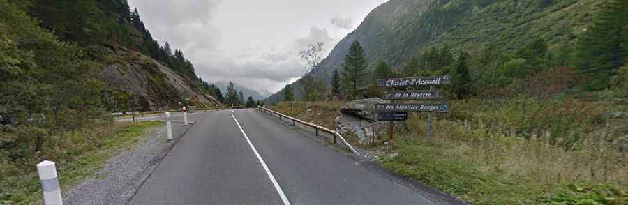
The pass is located in the Auvergne-Rhône-Alpes region, in the southeastern part of the country. At the top of the pass, you'll find the Aiguilles Rouges chalet reserve and a natural trail where you'll discover the flora and fauna of the Alps.
Is Col des Montets paved?
The road through the pass is fully paved. It’s called D1506. The road does not present any significant difficulties. The slope is never too steep (hitting a maximum gradient of 8.3% through some of the ramps), and the road surface is in excellent condition.
How long is Col des Montets?
The pass is 39 km (24.2 miles) long, running south-north from Chamonix (at the base of Mont Blanc in France) to Martigny (the capital city of the district of Martigny, canton of Valais, Switzerland). The pass appeared in the Tour de France several times.
Is Col des Montets open in winter?
Set high in the French Alps, the pass is generally open in winter but can get heavy snow. It can be closed anytime due to extreme weather or avalanche danger. Winter tires and/or snow chains are highly recommended! Check here the current road conditions. When the pass is closed, on the French side, vehicles can use a dual train tunnel called Tunnel des Montets (one lane controlled by signal). The tunnel has been converted to a dual-purpose railway tunnel which can also be used by cars and trucks.