The curvy road to San Bernardino Pass was built in 1770
Passo di San Bernardino is a high mountain pass at an elevation of 2.065m (6,775ft) above sea level, located in the Swiss canton of Graubünden.
Why is it called San Bernardino Pass?
The pass takes its present name from San Bernardino of Siena, who is said to have preached here in the early 15th century.
When was the road to San Bernardino Pass built?
The pass links the Hinterrhein and the Mesolcina valleys and has been in use since Roman times. The route first became important as a mule track in the fifteenth century. A road for wheeled vehicles was opened in 1770; this road was significantly improved between 1821 and 1823. It was called ‘The Italian Road’. Traffic flow was much facilitated when in 1967 the San Bernardino road tunnel was completed, since then vehicle traffic on the pass has been reduced, benefiting those taking the time to avoid the tunnel.
How long is the San Bernardino Pass?
The road to the summit is totally paved but very winding, with more than 40 hairpin turns. It’s called Route 13. The pass is 30.6 km (19.01 miles) long, running north-south from Hinterrhein, a village in the Viamala Region to Mesocco, a municipality in the Moesa Region.
Is the San Bernardino Pass challenging?
Located on the southeastern part of the country, the twisty road has more than 40 hairpin turns (most of them in the northern part). It is a pretty steep drive, hitting a 9.7% of maximum gradient through some of the ramps.
Is the San Bernardino Pass open?
Set high in the Lepontine Alps, in the Swiss Alps, the road to the dazzling mountain pass is only open from May to November since WWII.
How long does it take to drive San Bernardino Pass?
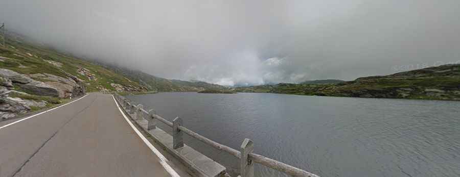
Plan about 45 minutes to complete the remarkable drive without stops, although you may want to block out extra time to stop, take photos, and explore the region it passes through. At the summit, you’ll find a small lake with deep blue water and a hospice. The scenic route includes majestic views of Switzerland at its best.