Driving the wild road to Capanna Adula in Ticino
Capanna Adula is a high mountain refuge at an elevation of 2.044m (6,706ft) above sea level, located in the canton of Ticino, in Switzerland.
Where is Capanna Adula?
The hut is located at the foot of the highest mountain in Ticino, in the district of Blenio, in the southern part of the country.
Iis the road to Capanna Adula unpaved?
The road to the refuge is mostly unpaved, with some paved parts at the beginning. A 4x4 vehicle is required.
How long is the road to Capanna Adula?
The road starts at Ghirone, a small town at 1.252m above sea level. The road is 13.1km (8.13 miles) long and includes 13 hairpin turns. Over this distance the elevation gain is 792 meters. The average gradient is 6.04%.
What to expect on the road to Capanna Adula?
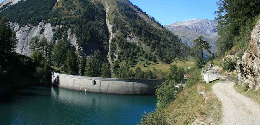
The road climbs up to Lago di Luzzone, a high mountain lake at an elevation of 1.606m (5,269ft) above sea level. One wall of the dam currently features the world's highest artificial climbing wall. Then the road climbs quite steeply up through very tight hairpins on a narrow road and comes into the tunnel Carassina (also known as Luzzone). This tunnel is the narrowest one you’ll probably see open to motorized vehicles. At the end of the tunnel, a gravel road takes you in 500m on a gentle ascent to Passo Muazz, at 1.700m (5,567ft) asl. Beyond this point, a little gravel road joins a little parking lot. The road continues to Lago di Carassino and Capanna Adula.
Pic: https://static.panoramio.com.storage.googleapis.com/photos/large/4856022.jpg