Driving the steep and narrow paved road to Täschalp
Täschalp is a high-altitude mountain settlement located at an elevation of 2,225 meters (7,299 ft) above sea level in the canton of Valais, Switzerland. Rising above the Matter Valley near Zermatt, the settlement is reached via a narrow paved mountain road starting from the village of Täsch.
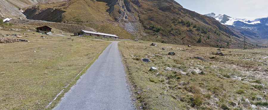
| Road facts: Täschalp | |
|---|---|
| Location | Täsch, Canton of Valais (Switzerland) |
| Elevation | 2,225 m (7,299 ft) |
| Length | 7.0 km (4.3 miles) from Täsch |
| Elevation Gain | 780 m (2,559 ft) |
| Average Gradient | 11.14% |
| Surface | Paved (Narrow) |
Where is the road to Täschalp located?
The road begins in the village of Täsch at the floor of the Matter Valley. The 7-kilometer route climbs the steep eastern mountain slopes toward Täschalp, located at the foot of the Mischabel mountain range.
How steep is the drive to Täschalp?
Starting from Täsch, the drive gains 780 meters of elevation in just 7 kilometers, resulting in a continuous average gradient of 11.14%. The road is fully paved but single-lane width with narrow bridges, tight switchbacks, and passing pockets. Caravans and campers are prohibited due to the road's narrow dimensions and steepness.
What hazards exist on the Täschalp road?
The primary hazard is the combination of the sustained 11.14% incline, single-lane width, and unprotected drops along the valley side. Meeting oncoming traffic forces one driver to reverse to a passing turnout. On the 780-meter descent back toward Täsch, drivers must shift into low gears to use engine braking and prevent brake pads from overheating.
Is the road to Täschalp open year-round?
No. Due to heavy snowfall and avalanche hazards in the Matter Valley, the road is closed during the winter months. Seasonal access typically opens in late spring once snowplows clear the route, remaining open through autumn.