What are the most spectacular roads in Switzerland?
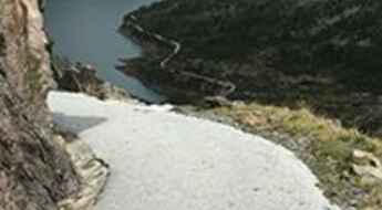
Nestled within the embrace of the Alps, Switzerland offers a driving experience unparalleled in its sheer majesty and engineering marvels. It's not merely about getting from one point to another; it's about the journey itself, replete with cinematic landscapes and pulse-racing twists and turns. Venture on the Furka Pass, a testament to both nature's grandeur and man's ingenuity, where every curve reminds you of the iconic James Bond chase from "Goldfinger."
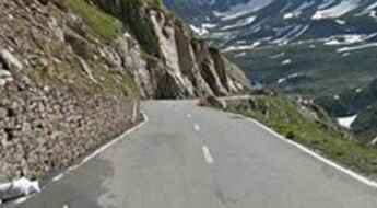
Then there's the St. Gotthard Pass, a mesmerizing ribbon of road that wends its way through granite cliffs and green valleys, echoing with the whispers of centuries gone by. As you ascend the Great St Bernard Pass, one of the Alpine giants, you'll be treated to panoramas that blend Switzerland's pristine beauty with the legacy of millennia-old travel routes.
Grimsel Pass, often heralded as a five-star road, combines the thrill of hairpin bends with the serenity of turquoise waters, ensuring that every kilometer driven is an experience to cherish. For those seeking the epitome of Alpine driving challenges, the Umbrail Pass awaits, with its staggering 35 hairpin turns, each offering a new perspective of the Swiss landscape.
In Switzerland, roads aren't just pathways; they are experiences, each narrating tales of nature's grandeur, human resilience, and moments that have shaped cinematic history. Buckle up and prepare to be enthralled, for Switzerland's roads promise memories that linger long after the journey is over.
A mostly paved road to Col du Lein
Col du Lein is a high mountain pass at an elevation of 1.623m (5,325ft) above the sea level, located in the Alps in the canton of Valais in Switzerland.
Glaubenbielen Pass, an iconic Swiss road
Glaubenbielen Pass is a high mountain pass at an elevation of 1.615m (5,298ft) above the sea level, located on the border of Obwalden and Lucerne cantons in Switzerland.
An awe-inspiring drive to Lac de Châteaupré
Lac de Châteaupré is a glacial lake at an elevation of 2.357m (7,732ft) above the sea level, located in the municipality of Grimentz, in the district of Sierre in the Swiss canton of Valais.
A brutally steep (35%) road to Col de Tanay
Col de Tanay is a high mountain pass at an elevation of 1.440m (4,724ft) above the sea level, located in Valais, Switzerland. The road to the pass is extremely steep, with sections up to 35%.
A wild road to Côté Verbier-Les Savoleyres
Côté Verbier-Les Savoleyres is a high mountain peak at an elevation of 2.374m (7,788ft) above the sea level, located in the canton of Valais in Switzerland.
If you love to drive, you'll love the road to Col de la Croix
Col de la Croix is a high mountain pass at an elevation of 1.778m (5,833ft) above the sea level, located in the canton of Vaud in Switzerland.
A challenging steep road to Passo Muazz
Passo Muazz is a high mountain pass at an elevation of 1.700m (5,567ft) above the sea level, located in the district of Blenio, in the canton of Ticino, Switzerland.
The road to Heimischgarten isn’t an easy one
Heimischgarten is a high mountain pass at an elevation of 2.770m (9,087ft) above the sea level, located in the district of Visp in the canton of Valais in Switzerland. It's one of the highest roads of Europe.
Travel guide to the top of Chasseral
Chasseral is a high mountain pass at an elevation of 1.606m (5,269ft) above the sea level, located in the Jura Mountains, in the Swiss canton of Bern.
The unpaved drive to Unterrothorn offers stunning views
Unterrothorn is a high mountain peak at an elevation of 3.109m (10,200ft) above the sea level, located in southern Switzerland’s Valais canton. It’s one of the highest roads of Europe.
A scenic paved road to Wolfgang Pass in the Swiss Alps
Wolfgang Pass is a high mountain pass at an elevation of 1.631m (5,351ft) above the sea level, located in the canton of Graubünden in Switzerland.
An epic enthralling road to Strassberger Fürggli
Strassberger Fürggli is a high mountain peak at an elevation of 2.109m (6,919ft) above the sea level, located in the Swiss canton of Graubünden.
Lac du Vieux Emosson, a narrow road with 15% parts and unlit tunnels
Lac du Vieux Emosson is a high mountain reservoir at an elevation of 2.205m (7,234ft) above the sea level, located in Valais, Switzerland. The road is closed to vehicles.
Adventure along the mule track to Scaletta Pass
Scaletta Pass (Scalettapass) is a high mountain pass at an elevation of 2.606m (8,550ft) above the sea level, located in the canton of Graubünden, Switzerland.
Moosalp (Col de Moos): an epic road in the Alps
Moosalp (also called Col de Moos) is a high mountain pass at an elevation of 2.048m (6,719ft) above the sea level, located across the western Pennine Alps, in the canton of Valais in Switzerland.
Driving the 7 Most Famous Alpine Roads of Switzerland
Located on the central part of Europe, Switzerland remains one of the most popular travel destinations on the planet, with snowcapped mountains, green meadows and shimmering lakes.
An epic climb to Col de l'Aiguillon in the Jura Mountains
Col de l'Aiguillon is a mountain pass at an elevation of 1.293m (4,242ft) above the sea level, located in the canton of Vaud, in Switzerland. The pass is very close to the French-Swiss border.
Alpe Galm, one of the hardest roads of the Alps
Alpe Galm is a high mountain peak at an elevation of 2.231m (7,319ft) above the sea level, located in the canton of Valais in Switzerland.
A steep curvy road to Barrage de Cleuson
Lac de Cleuson is a high mountain reservoir at an elevation of 2.186m (7,171ft) above the sea level, located in the district of Conthey in the canton of Valais in Switzerland.
The completely deserted road to Col de Chaude
Col de Chaude (also known as Col de Chaudoz) is a high mountain pass at an elevation of 1.600m (5,300ft) above the sea level, located in the canton of Vaud, Switzerland, in the district of Aigle. For 11 out of the 13 km to the top, the road is well above 10% on average.
An iconic road to Griessee in the Swiss Alps
Griessee is a high mountain lake at an elevation of 2.386 m (7,828 ft) above the sea level, located in Valais, in the southwestern part of Switzerland.
The scenic trail from Gemmipass to Daubensee
Daubensee is a high mountain lake at an elevation of 2.205 m (7,234 ft) above the sea level, located in Valais, Switzerland.
A memorable road trip to Strelapass
Strelapass is a high mountain pass at an elevation of 2.352m (7,716ft) above the sea level, located in the district of Prättigau/Davos in the canton of Graubünden, Switzerland.
The road to Alp Anarosa is not for timid drivers
Alp Anarosa is a high mountain pass at an elevation of 2.348m (7,703ft) above the sea level, located north of Splügen, in the Viamala Region in the Swiss canton of Graubünden.
The road to Passo Scimfuss, a chillout in high mountains
Passo Scimfuss is a high mountain pass at an elevation of 2.242m (7,355ft) above the sea level, located in the district of Leventina in the canton of Ticino in Switzerland.
Road trip guide: conquering Grubengletscher
Grubengletscher is a high mountain pass at an elevation of 2.862m (9,389ft) above the sea level, located in the district of Visp in the canton of Valais in Switzerland. It’s one of the highest roads of the country.
A curvy paved road to Lago della Sella
Lago della Sella is a high mountain reservoir at an elevation of 2.297m (7,536ft) above the sea level, located in the canton of Ticino, Switzerland.
A 5-star road to Forcola di Livigno Pass in the Alps
Livigno Pass-Forcola di Livigno Pass is an international high mountain pass at an elevation of 2,315m (7,595ft) above sea level, located on the border between Switzerland and Italy.
Driving the wild Col des Mines
Col des Mines is a high mountain pass at an elevation of 2.327m (7,634ft) above the sea level, located in the district of Entremont in the canton of Valais, Switzerland.
The road to Luzzone Lake: an average gradient of 9.5%
Lago di Luzzone is a high mountain reservoir at an elevation of 1.613m (5,291ft) above the sea level, located in the district of Blenio in the canton of Ticino in Switzerland.
A narrow scenic road to Mont Tendre
Mont Tendre is a high mountain pass at an elevation of 1.679m (5,508ft) above the sea level, located in the Jura mountains, in the canton of Vaud, in Switzerland. It’s another of those amazing, steep, deserted Jura roads climbing through the woods
A memorable road trip to Lake Lei
Lago di Lei is an artificial high mountain lake at an elevation of 1.945m (6,381ft) above the sea level, located in in the district of Hinterrhein in the Swiss canton of Graubünden.
The picturesque road to Pas de Morgins
Pas de Morgins is an international high mountain pass at an elevation of 1.378m (4,520ft) above the sea level, located on the border of France and Switzerland.
A memorable road trip to Lai da Vons
Lai da Vons is a high mountain lake at an elevation of 1.991m (6,532ft) above sea level peacefully nestled between the Rheinwald forest and Val Schons, in the district of Hinterrhein in the Swiss canton of Graubünden.
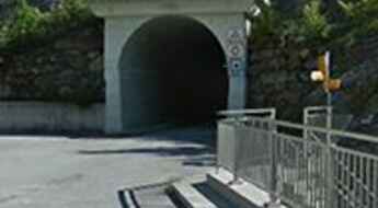
Driving the wild Tälligrattunnel
Tälligrattunnel is a high mountain tunnel located in the canton of Valais in Switzerland.
Bassa della Sella, a Most Tricky Scenic Road
Bassa della Sella is a high mountain pass at an elevation of 2.138m (7,014ft) above the sea level, located in the canton of Ticino, Switzerland.
