Driving the scenic road to Pla de la Feixa
Pla de la Feixa is a high mountain plateau situated at an elevation of 2,212m (7,257ft) above sea level. It is located in the comarca of Cerdanya, in the province of Girona, Catalonia. This plateau sits in the heart of the Pyrenees mountain range, near the French border, between the picturesque towns of Meranges and Guils de Cerdanya.
| Road facts: Pla de la Feixa | |
|---|---|
| Location | Cerdanya, Catalonia (Spain) |
| Length | 14 km (8.7 miles) |
| Elevation | 2,212 m |
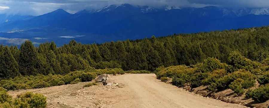
| Surface | Forest track (Unpaved) |
| Route | Refugi Malniu to Guils de Cerdanya |
| Hazard Level | Low/Moderate (Seasonal snow) |
Is the road to Pla de la Feixa paved?
No, the road to the plateau is a forest track. While the surface is generally in good condition and suitable for most cars during the dry season, it remains an unpaved mountain route. The track takes drivers through a high mountain environment typical of the Pyrenees. Due to its altitude, the road is inaccessible during most of the winter due to snow, and it is highly recommended to plan the drive from late spring to early fall.
How long is the road to Pla de la Feixa?
The road is 14 km (8.7 miles) long, running in a west-east direction. It connects the Refugi de Malniu in the west with the village of Guils de Cerdanya in the east. The drive offers stunning views of the surrounding peaks and provides access to the Refugi de la Feixa, located near the highest point of the plateau.
What are the main attractions along the road to Pla de la Feixa?
The drive is famous for its proximity to some of the most beautiful spots in the Cerdanya region. From the road, it is highly recommended to stop at the Refugi de la Feixa and take the short hike to the famous Malniu Lake (Estany de Malniu). The plateau itself is a vast alpine meadow that serves as a perfect vantage point to see the entire Cerdanya valley and the Cadí-Moixeró range to the south.
Pic: Claudio Guida