How to drive the unpaved Pista de Boumort in the Pre-Pyrenees?
The Refugi de Boumort is a high mountain hut at an elevation of 1,886m (6,187ft) above sea level, located in the province of Lleida, Catalonia. Situated within the Serra de Boumort National Hunting Reserve, the access is via the Pista de Boumort, a technical unpaved artery that remains the only unrestricted transit for non-authorized vehicles in this high-altitude sector of the Pre-Pyrenees.
| Road facts: Pista de Boumort | |
|---|---|
| Location | Pallars Jussà, Lleida (Spain) |
| Elevation | 1,886 m (6,187 ft) |
| Surface | Unpaved (Gravel / Limestone debris) |
| Vehicle | 4x4 Mandatory / High-clearance |
| Status | Seasonal (Snow closure in winter) |
Where is the Refugi de Boumort?
The refuge is located in the Pallars Jussà comarca, specifically within the rugged limestone ridges of the Serra de Boumort. Logistically, the route crosses the municipal boundaries of Conca de Dalt and Abella de la Conca. The ascent starts southeast of the junction where the Hortoneda and Masos de la Coma tracks meet, serving as a primary logistical corridor for the National Hunting Reserve.
Is the road to Refugi de Boumort unpaved?
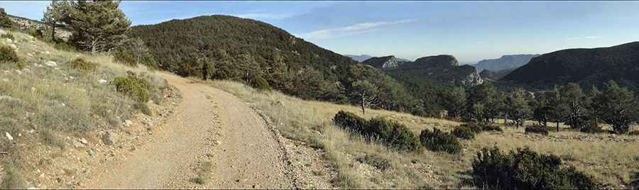
Yes, the Pista de Boumort is entirely unpaved. Technically, the track consists of loose gravel and sharp limestone debris, requiring heavy-duty tires to prevent sidewall punctures. While it is the main artery for the reserve, the roadbed is primitive and subject to severe erosion after the spring rains. A high-clearance 4x4 vehicle is mandatory to drive the rocky ramps and manage the irregular terrain between Sant Andreu and the Obaga de la Coma.
How long is the road to Refugi de Boumort?
The track is a sustained high-altitude transit that climbs rapidly through a series of sharp switchbacks at Serrat de la Capella. Technically, the road does not reach the peak of Cap de Boumort but skirts the summit to reach the refuge at 1,886m. Logistically, the drive involves traversing the high meadows of Pletiu Sobirà and the Serra de Planell Ras, where the track bed is exposed to extreme weather conditions and lacks any roadside assistance or fuel services.
When is the best time to drive the Pista de Boumort?
The route is typically impassable from late fall to early spring due to heavy snow accumulation and ice on the northern slopes. The optimal logistical window is between late spring and early October. Technically, during late September, the deer rutting season (Brama del Cérvol) increases vehicle traffic in the area, requiring extreme caution on the narrowest sections of the shelf road where passing room is restricted.
What are the technical driving challenges in Boumort?
Technically, the 1,886m descent puts a significant thermal load on the braking system. The use of low-range gearing and engine braking is essential to maintain vehicle control on the loose limestone ramps of the Carreu Valley. Logistically, drivers must stay on the main Pista de Boumort, as several secondary paths (Camins de Boumort) are strictly restricted to authorized park personnel. The final stretch to the refuge involves managing high-torque maneuvers on uncompacted soil, especially near the Clot de la Dona Morta.
Pic: Josep Batriu