Alto de la Farrapona is a Cycling Must
Alto de la Farrapona is a high mountain pass at an elevation of 1,708m (5,603ft) above sea level, located in Spain. The pass has already made a name for itself.
Where is Alto de la Farrapona?
The pass is located on the border between the Principality of Asturias and the province of León, in the autonomous community of Castile and León, in the northwestern part of the country.
Is Alto de la Farrapona paved?
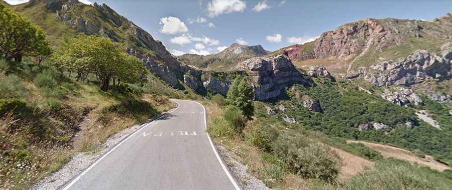
The road to the summit is fully paved. It is called SD-1 and was asphalted in 2011 when it served as an occasional stage finish in Vuelta a España. It’s the highest asphalted road in this region.
How long is Alto de la Farrapona?
The road through the pass is 26km (16.15 miles) long, running west-east from AS-227 Road, near Pola de Somiedo (in Asturias) to LE-481 Road, near Torrestío (in León).
How steep is Alto de la Farrapona?
This is a cycling must. The final 6km averages around 9% with some parts up to 15.4%.
Is Alto de la Farrapona open in winter?
Set high in Somiedo Natural Park, a natural park in the central area of the Cantabrian Mountains, the road is usually open year-round, but short-term closures are common in winter.
Is Alto de la Farrapona worth it?
At the summit, there’s a big parking lot. The scenery is stunning, and you will be blown away by its beauty. The drive offers a beautiful panoramic view.