Driving the forest track to Adou del Bastareny in the Pyrenees
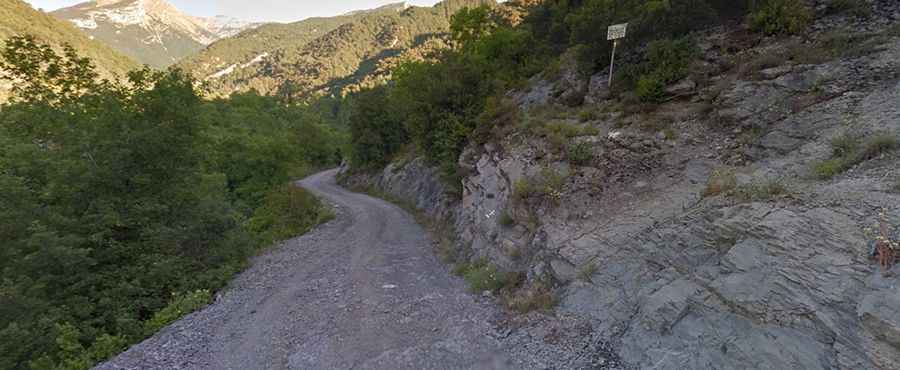
Adou del Bastareny is the karst spring source of the Bastareny River at an elevation of 1,013 meters (3,323 ft) above sea level, located within the Cadí-Moixeró Natural Park in the Berguedà comarca of Catalonia, Spain. Traversed by the unpaved Camí de Monell track, the route connects Bagà with the trailhead near the limestone waterfall.
| Road facts: Adou del Bastareny | |
|---|---|
| Location | Bagà, Berguedà, Barcelona (Spain) |
| Elevation | 1,013 m (3,323 ft) |
| Road Name | Camí de Monell |
| Length | 6.9 km (4.3 miles) from Bagà |
| Hairpin Turns | 5 switchbacks |
| Surface | Unpaved (Compact gravel and dirt) |
| Vehicle Required | Standard car / High-clearance vehicle after storms |
Where is the road to Adou del Bastareny located?
The climb begins in Bagà, branching off the BV-4024 road. The 6.9-kilometer unpaved Camí de Monell follows the Bastareny river valley into the Cadí-Moixeró Natural Park, ending at the parking clearing near the spring at 1,013 meters elevation.
What are the surface and driving conditions on the Camí de Monell?
The 6.9-kilometer route is entirely unpaved, consisting of packed gravel, forest soil, and exposed rocks. The track features 5 tight hairpin turns as it climbs along the valley floor. High ground clearance is helpful following heavy rains, which carve water ruts across the dirt roadbed.
What hazards exist on the road to Adou del Bastareny?
The single-lane forest track lacks central markings and crash barriers along river drop-offs. Passing oncoming traffic requires stopping or reversing to narrow turnouts. High forest humidity keeps shaded gravel curves slick, while heavy rains wash loose stone debris onto the driving line.
Is the road to Adou del Bastareny open in winter?
Yes. At an elevation of 1,013 meters, the track remains accessible year-round. However, cold snaps cause black ice to form along riverbank shadows, requiring winter tires or cautious throttle control during freezing periods.