Driving the 4x4 track to Pico Labert: 2,316m in the Benasque Valley
Pico Labert is a high mountain peak at an elevation of 2,316m (7,598ft) above sea level, located in the heart of the Pyrenees, in the Ribagorza region of Huesca. Set high in the Benasque Valley, this peak is a rugged balcony over the Aragonese mountains. It is one of the highest roads in Spain.
| Road facts: Pico Labert | |
|---|---|
| Location | Benasque, Huesca (Spain) |
| Elevation | 2,316 m (7,598 ft) |
| Road Name | Access track from A-2617 |
| Length | 4.6 km |
| Surface | Unpaved / Steep rocky trail |
Where is Pico Labert?
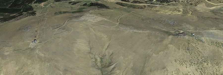
The peak is situated in the province of Huesca, towering over the Benasque Valley near the Cerler ski area. The route starts from the paved A-2617 road, leaving the asphalt behind to enter a world of grey rock and thin air. This is a lonely and exposed area where the geography is dominated by the massive granite peaks of the Pyrenees, and the isolation increases with every meter of elevation you gain.
Is the road to Pico Labert unpaved?
The road to the summit is totally unpaved and requires a high-clearance 4x4. It is a service trail to maintain ski lifts and lodges, where the surface is a mix of loose stones, deep ruts, and mountain soil. One of the main challenges is the "step" nature of the track; the lower part is a typical forest road, but as you approach the upper section, the ground becomes even steeper and more rocky. Remember it is a functional service track, meaning it was never built for comfort, but for the heavy machinery that keeps the ski resort running in the winter months.
How long and steep is the road to Pico Labert?
The climb is 4.6 km long, but its shortness is deceptive. The slope is very steep, and the lack of oxygen at over 2,300 meters will significantly reduce your engine’s power. The most technical part is the final stretch, where the incline sharpens and the loose stones make traction a constant struggle.
When is the road to Pico Labert open?
Due to its high elevation in the Aragonese Pyrenees, this trail can only be done in a very narrow time-frame, usually at the end of August. For most of the year, the road is buried under several meters of snow or is completely blocked by mud and slush during the melt. Even in summer, mountain storms can turn the dirt sections into a slippery mess in minutes. Always check the weather for the Benasque area before attempting the drive.
What are the hazards of driving this ski service road?
The road is narrow, and in many places, there is no room to turn around or pass another vehicle. If you meet a maintenance crew coming down, be prepared to reverse to a safer spot on the ridge.