How to get to La Negrita in Tenerife?
La Negrita is a high mountain peak at an elevation of 2,223m (7,293ft) above sea level, located on the island of Tenerife, in the Canary Islands of Spain.
Where is La Negrita?
The peak is situated within the Corona Forestal Natural Park, the largest protected natural area in the Canary Islands. It lies in the high ridges of the island, north-east of the Teide National Park, and offers panoramic views of the Orotava Valley and the Teide volcano.
🇪🇸 La Negrita Road Data
| Elevation | 2,223m (7,293ft) |
| Location | Corona Forestal, Tenerife |
| Distance | 1 km (from TF-24) |
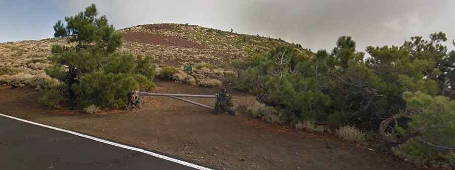
| Access | Restricted (Wooden Barrier) |
Is the road to La Negrita unpaved?
The road to the summit is totally unpaved, consisting of a narrow track of volcanic soil and gravel. While the surface is generally in good condition, a high-clearance 4x4 vehicle is required for traction and clearance. The access is strictly regulated and totally closed to private motor vehicles with a wooden barrier; specialized permits from the local government (Cabildo de Tenerife) are typically required for authorized access.
How long is the road to La Negrita?
Starting from Puerto de Izaña on the TF-24 Road (also known as Carretera de la Esperanza), the track to the summit is 1km (0.62 miles) long. The route climbs steadily through a landscape of high-altitude scrubland, specifically the Teide broom (Spartocytisus supranubius), leaving behind the pine forest as it reaches the volcanic ridges.