Tuc de Costarjàs: Driving the Ski Service Road in Val d'Aran
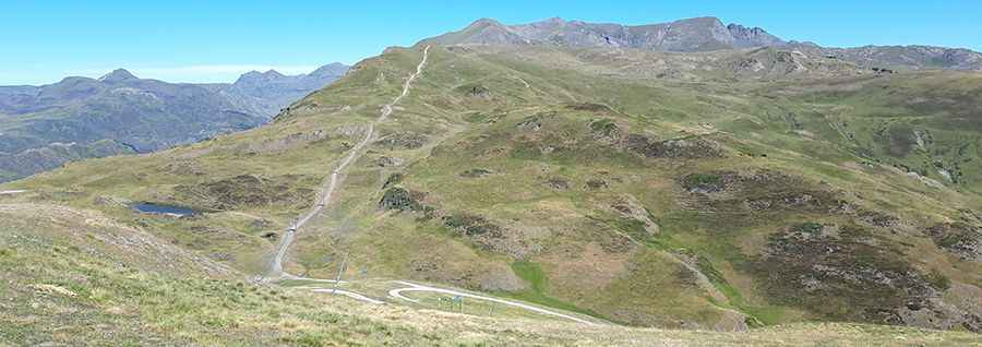
Tuc de Costarjàs is a high mountain peak at an elevation of 2,337m (7,667ft) above sea level, located in the province of Lleida, in Spain. It's one of the highest roads in the country.
| Road facts: Tuc de Costarjàs | |
|---|---|
| Elevation | 2,337 m (7,667 ft) |
| Distance | 2.1 km (1.30 miles) |
| Max Gradient | 18% |
| Surface | Unpaved / Rocky track |
Where is Tuc de Costarjàs?
The peak, also known as Tuc deth Mei, is located in the Val d'Aran, in the autonomous community of Catalonia, in the northeastern part of the country.
Is the road to Tuc de Costarjàs unpaved?
The road to the summit is totally unpaved. It’s a chairlift access trail of the Baqueira-Beret ski resort. It is a steep mountain track with sections reaching a maximum gradient of 18%. Due to the loose rocky surface and steepness, a 4x4 vehicle is required.
How long is the road to Tuc de Costarjàs?
Starting from Cap de Blanhiblar, the track is 2.1 km (1.30 miles) long. The route features 6 turns and includes a notably straight section of 1.19 km (3,916 ft) that leads to the summit.
Is the road to Tuc de Costarjàs open year-round?
Set high in the northwestern part of the Pyrenees, near the French border, the road is only passable during the summer months. During the winter and spring, the track is covered by snow and is used exclusively for skiing activities.