How steep is the 4x4 track to Montanha deth Dossau in the Pyrenees?
Montanha deth Dossau (also known as Tuc deth Dossau) is a high mountain peak at an elevation of 2,515 meters (8,251 ft) above sea level in the Val d'Aran, Catalonia, Spain. Traversed by an unpaved service track within the Baqueira-Beret ski resort, the route ranks among the highest roads in Spain.
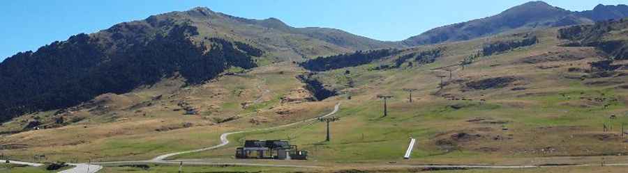
| Road facts: Montanha deth Dossau | |
|---|---|
| Location | Pla de Beret, Val d'Aran, Catalonia (Spain) |
| Elevation | 2,515 m (8,251 ft) |
| Length | 3.6 km (2.23 miles) from Beret parking lot |
| Elevation Gain | 665 m (2,181 ft) |
| Average Gradient | 18.47% |
| Max Gradient | 25% |
| Surface | Unpaved (Loose stones, dirt, and rock ledges) |
| Vehicle Required | Prepared 4x4 with low range |
Where is the road to Montanha deth Dossau located?
The climb begins at the Pla de Beret parking area within the Baqueira-Beret resort. The 3.6-kilometer track ascends 665 vertical meters straight up the ski slopes to the 2,515-meter peak.
How steep is the track to Montanha deth Dossau?
The 3.6-kilometer route is exceptionally steep, maintaining an average gradient of 18.47% with maximum ramps reaching 25%. The unpaved surface consists of loose shale, dirt, and rock steps where low-range 4x4 and high clearance are required to maintain traction without spinning wheels.
What hazards exist on the Dossau track?
The single-lane service path lacks safety barriers and drainage. Stopping on the 25% loose gravel ramps risks loss of forward momentum or sliding backward. Sudden summer rainstorms turn the loose earth into slick mud, creating severe lateral slide risks on the steep descent back to Beret.
When is the road to Montanha deth Dossau open?
Due to its high elevation of 2,515 meters, snow buries the track for most of the year. The route is impassable outside a short summer window, typically clearing only by late August before autumn snows return.