Driving the Templar track to Castillo de Montalbán: 2km of rock and history
Castillo de Montalbán is a 12th-century fortress located in the Toledo province of Castile-La Mancha, Spain. Situated near the Torcón River, the historic site is accessed via a short unpaved rural track that branches off the main regional road network.
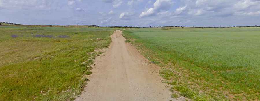
| Road facts: Castillo de Montalbán | |
|---|---|
| Location | San Martín de Montalbán, Toledo (Spain) |
| Road Name | Access track from CM-4009 |
| Length | 2.23 km (1.38 miles) |
| Surface | Unpaved (Gravel and rocks with deep potholes) |
How to get by car to Castillo de Montalbán?
The access route to the fortress starts directly from the paved CM-4009 road, just outside the town of San Martín de Montalbán. The unpaved track is 2.23 kilometers (1.38 miles) long and runs through rolling rural fields toward the castle perimeter. The path consists of a single unpaved lane with no lateral markings or artificial lighting.
What are the road conditions on the Castillo de Montalbán track?
The entire 2.23 km lane is unpaved, featuring a rough surface of loose gravel, embedded stones, and deep potholes. Standard passenger cars risk scraping the underbody against the high center ridges of the track. After heavy rains, the deep holes accumulate standing water, hiding their actual depth and creating soft mud patches. High ground clearance is useful to clear the exposed bedrock formations along the trail.
Is there a parking area at Castillo de Montalbán?
The unpaved track ends blindly near the fortress walls, where the driving surface becomes highly irregular and narrow. The turnaround area is tight and consists of unpaved, rough dirt shoulders with no asphalted surfaces or dedicated parking spaces. Large vans and long vehicles face limited space for shunting due to the proximity of the stone slopes and low tree branches lining the track edges.