Calar de Santa Bárbara: Driving the high-altitude mine track in Sierra de Baza
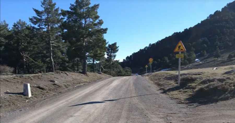
Calar de Santa Bárbara is a mountain peak at an elevation of 2,218 meters (7,276 ft) above sea level, located in the Sierra de Baza Natural Park in the province of Granada, Andalusia, Spain. Sitting as the highest point in the Sierra de Baza, the summit is reached via an unpaved former mining track that climbs the northern slopes above the Baza basin.
| Road facts: Calar de Santa Bárbara | |
|---|---|
| Location | Baza, Granada, Andalusia (Spain) |
| Elevation | 2,218 m (7,276 ft) |
| Surface | Unpaved (Gravel, loose rocks, and old mining track) |
| Primary Hazards | Loose mining debris, deep ruts, and lack of safety barriers |
| Vehicle Required | High-clearance 4x4 with low-range gearing |
Where is the road to Calar de Santa Bárbara located?
The track is located in eastern Granada within the Sierra de Baza Natural Park. Starting from lower forest tracks near Caniles or Baza, the route climbs through the Prados del Rey plateau toward the geodetic vertex at the 2,218-meter summit.
How difficult is the drive to Calar de Santa Bárbara?
The climb follows an unpaved former mining track consisting of coarse gravel, sharp stones, deep ruts, and loose rock debris. The final sector approaching the peak features steep, unpaved switchbacks where loose surface material reduces wheel traction. High ground clearance and four-wheel drive with low-range gearing are necessary to navigate the steep ramps and uneven rock steps.
What hazards exist on the Sierra de Baza mining track?
The single-lane dirt track lacks safety barriers along exposed slopes leading down toward the Hoya de Baza ravines. Sharp limestone and mining debris present a high risk of tire sidewall cuts. Heavy rainstorms erode the track, creating deep water channels across the driving line. On the descent from 2,218 meters, low-range gearing is required to engine brake and prevent brake pads from overheating on the loose stone surface.
Is the road to Calar de Santa Bárbara open in winter?
No. At 2,218 meters elevation, heavy snowfall and ice block the upper tracks across the Prados del Rey sector from late autumn through spring. Snowplows do not clear this high-altitude forest and mining track, leaving the summit unreachable by vehicle until the seasonal spring thaw.
Pic: Jesús Pérez