Driving the service road to Collado de las Yeguas: 2,859m in Sierra Nevada
Collado de las Yeguas is a high mountain pass at an elevation of 2,859 meters (9,379 ft) above sea level, located in the Granada province of Andalusia, Spain. Set high in the upper reaches of the Sierra Nevada range, the unpaved route is a service road for the ski resort machinery and chairlift maintenance. It is of the highest mountain roads in Spain.
| Road facts: Collado de las Yeguas | |
|---|---|
| Location | Sierra Nevada, Granada, Andalusia (Spain) |
| Elevation | 2,859 m (9,379 ft) |
| Length | 5.2 km from A-395 |
| Max Gradient | 20% |
| Surface | Unpaved (Loose shale and gravel) |
Where does the road to Collado de las Yeguas start?
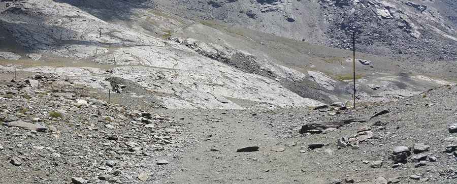
The 5.2-kilometer mountain track begins at the end of the paved A-395 highway, entering the restricted service area of the Sierra Nevada ski station. The route climbs through an alpine environment dominated by loose shale and bare rock slopes. The lane terminates at the upper installations of the ski resort.
Is the track to Collado de las Yeguas difficult to drive?
The road is entirely unpaved, featuring a rough and unstable surface of loose stone fragments, gravel, and sharp shale. The short climb features continuous steep inclines with maximum gradients hitting 20% on the upper ramps. A high-clearance 4x4 vehicle is required to clear the uneven track profile.
Is the Collado de las Yeguas road open year-round?
Due to its extreme 2,859-meter altitude, the track is completely buried under meters of snow for most of the year, forming part of the active ski slopes. The path becomes clear of snow only for a narrow window during the late summer months, typically between August and September. Sudden summer storms cause rapid runoff, creating deep erosion ruts across the unpaved track and leaving the narrow ridge exposed to high winds and thick cloud cover.
Pic: Kminante del Sur