How difficult is the 4x4 road to Cerro del Gargantón in Spain?
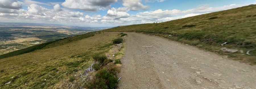
Cerro del Gargantón is a mountain summit at an elevation of 1,789 meters (5,869 ft) above sea level in the Sierra de Guadarrama, located on the border between the Community of Madrid and the Province of Segovia (Castile and León), Spain. Traversed by an unpaved ridge track above the Lozoya Valley, the route serves mountain pastures and paragliding launch sites near the Peñalara massif.
| Road facts: Cerro del Gargantón | |
|---|---|
| Location | Madrid / Segovia border, Sierra de Guadarrama (Spain) |
| Elevation | 1,789 m (5,869 ft) |
| Surface | Unpaved (Crushed granite, loose gravel, and dirt) |
| Vehicle Required | High-clearance 4x4 |
Where is the road to Cerro del Gargantón located?
The unpaved track runs along the high ridge dividing the Lozoya Valley in Madrid from the Segovian plains. The mountain route climbs past granite outcrops to the summit launch area at 1,789 meters elevation.
What are the driving conditions on the Cerro del Gargantón track?
The route is entirely unpaved, consisting of loose dirt, coarse granite gravel, and embedded rock steps. High ground clearance and four-wheel drive are required to manage axle articulation over deep ruts and maintain tire traction on steep gravel inclines.
What hazards exist on the Cerro del Gargantón mountain route?
The open ridge track lacks guardrails along steep, exposed mountain slopes. Summer rainstorms rapidly wash away soil, creating deep cross-track water ruts and turning dry earth into slick mud. Sharp granite stones along the driving line pose a constant risk of tire sidewall cuts, while hikers and paraglider support vehicles frequently share the narrow path.
Is the road to Cerro del Gargantón open in winter?
No. At an elevation of 1,789 meters, heavy snow accumulation and ice bury the track from November through May. Snowplows do not clear this unpaved ridge route, leaving it impassable to motor vehicles throughout the winter months.
Pic: Carlos M