Driving the Pista de las Cumbres: From Puerto de la Linera to Peña Berrocosa
The Pista de las Cumbres is a high-altitude unpaved mountain track running along the geographic border between the Community of Madrid and the province of Segovia, Spain. The route follows the spine of the Somosierra sector, linking the mountain passes of Puerto de la Linera, Cerro del Jabinar, and Peña Berrocosa.
| Road facts: Pista de las Cumbres | |
|---|---|
| Location | Madrid - Segovia Border, Central Spain |
| Highest Point | 1,959 m (Peña Berrocosa) |
| Surface | Unpaved / Loose Slate, Gneiss & Dirt |
| Track Type | Fire surveillance / Ridgeline service track |
| Vehicle Required | High-clearance 4x4 with low-range gears |
Where does the Pista de las Cumbres route run?
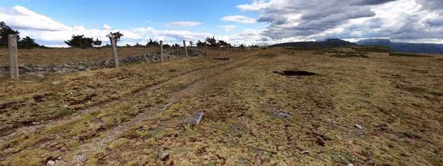
The fire surveillance track runs along the ridge dividing the northern Castilian plateau from the Lozoya Valley. The northern access point begins near Puerto de la Linera (41.0751, -3.7114), an old mountain pass crossing above the municipalities of Arcones and Robregordo. Moving south along the continuous mountain crest, the single-lane track passes Cerro del Jabinar at 1,847 meters before ending near the geodesic marker of Peña Berrocosa at an elevation of 1,959 meters (6,427 ft).
What is the track surface of the Peña Berrocosa road?
The entire ridge route is unpaved, consisting of a hard-packed dirt base heavily mixed with loose shale and sharp gneiss rock fragments. The lane is single-vehicle width with narrow, unpaved shoulders that drop off steeply on both the Segovian and Madrilenian sides. The path entirely lacks steel guardrails or concrete boundaries, leaving wheels exposed to the open mountain slopes along the exposed crest lines.
How challenging is the climb over Cerro del Jabinar?
The route remains consistently above 1,800 meters altitude, featuring steep slopes and sharp terrain ruts. The final ascent to Peña Berrocosa contains loose limestone and slate rocks that shift under tire pressure, demanding continuous traction management. Heavy mountain thunderstorms rapidly erode the dirt foundation, carving deep longitudinal gutters across the track that can catch vehicle differentials or scrape low-hanging undercarriages.
Is the Pista de las Cumbres pass open in winter?
From December to April, the high-altitude crest is frequently blocked by heavy snowfall and deep drifts. The combination of freezing temperatures and water accumulation turns the dirt and clay sections into slick mud fields and sheets of black ice, making the track impassable for standard vehicles. The area features no cellular signal coverage, roadside safety bays, or fueling points between the lower mountain access gates.
Pic: Carlos M