Driving the Curvy TF-12 Road in the Canary Islands
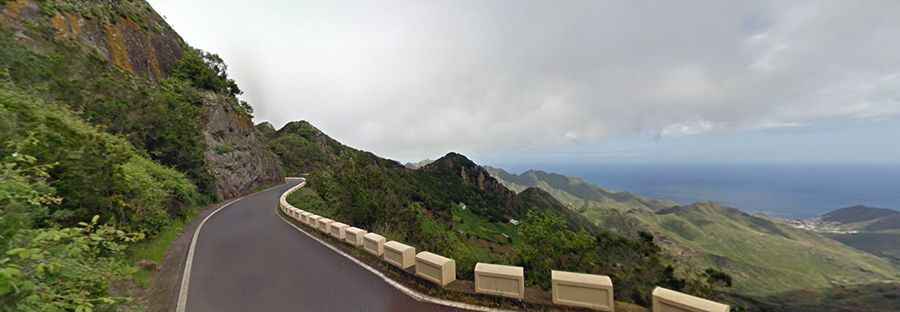
Located on the island of Tenerife, in Spain’s Canary Islands, the TF-12 road is, probably, one of the most enjoyable routes to cycle in the whole of Spain. This quiet highway cuts through the Anaga mountain range.
How long is the TF-12 road in the Canary Islands?
This exciting journey is 28.8 km (17.89 miles) long. The paved road includes some narrow sections scarcely wide enough for two cars to pass at the same time. The drive is not for the faint of heart. There are a number of blind corners with sheer drops. This route should not be attempted by those who don't know how to reverse. This quiet highway cuts through the Anaga mountain range in the northeast of the island.
Where does the TF-12 road in the Canary Islands start and end?
The tangled ribbon of TF-12 starts from San Andrés at sea level, heading up to the mountains. Its highest elevation is 871 meters above sea level, ending near Las Mercedes village, on the T13 road. It is a gentle climb which will slowly become steeper as you approach the mountains. With more than 100 turns, this route is not recommended if your passengers are prone to car sickness. Eventually, you might feel nauseous. Take extreme care with landslides and rockfalls. The road surface is excellent, and the road carries relatively little traffic.
Is the TF-12 road in the Canary Islands worth the drive?
Located within the Rural de Anaga Park, it's a gorgeous ride, through shaded woodland, often cutting through cliff faces. It’s said to be one of the best driving roads in the world. The journey offers an exhilarating driving experience, with superb views winding its way through the Anaga Range for incredible vistas. This is definitely one road trip that you want to record with lots of photographs. You have to remember to keep your eyes on the road and not the incredible vistas. If you are lucky and it happens to be clear, you can catch a glimpse of Gran Canaria on the horizon.