Is the gravel road to Pic de l’Àliga suitable for all vehicles?
Pic de l’Àliga is a mountain peak at an elevation of 460m (1,509ft) above sea level, located on the border of the Alt Penedès and Garraf comarcas in Catalonia, Spain.
Where is Pic de l’Àliga?
The peak, also known as Puig de l’Àliga, is located in the province of Barcelona, in the northeastern part of the country.
| Road facts: Pic de l’Àliga | |
|---|---|
| Elevation | 460m (1,509ft) |
| Start Point | BV-2443 road (261m) |
| Length | 3.3 km (2.05 miles) |
| Max Gradient | 12% |
| Surface | Gravel / Loose Stone |
Why is there a road to Pic de l’Àliga?
At the top, you will find a metallic fire lookout tower. The summit provides a 360-degree vantage point that is critical for wildfire surveillance. On clear days, the visibility is extraordinary: you can see the vineyards of the Penedès, the jagged peaks of Montserrat, and even the Pyrenees to the north. Looking south, the Mediterranean Sea is clearly visible, and some days it is not uncommon to spot the mountains of Mallorca.
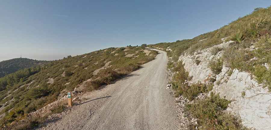
Is the road to Pic de l’Àliga paved?
The road to the summit is totally unpaved beyond the initial turn-off. The surface consists of typical Garraf limestone gravel and packed dirt. Because of the "karstic" nature of the massif, the road can develop deep ruts and "washboard" patterns after heavy rains. High-clearance vehicles are recommended, although standard cars can often make the trip if driven with extreme care. The track features significant drops without guardrails, particularly on the tighter bends.
How long is the road to Pic de l’Àliga?
The ascent begins at the BV-2443 road, near the boundary between Canyelles and Olèrdola. The climb to the peak is 3.3 km (2.05 miles) long. Starting from an altitude of 261m, the road gains 199 meters of elevation. While the average gradient is 6.03%, it hits a 12% of maximum gradient through some of the ramps.
When is the best time to drive the road to Pic de l’Àliga?
Set high in the rugged Garraf Massif, part of the Catalan Coastal Range, the road is open year-round. During the summer months, the area experiences extreme heat and high fire risk. Be aware that there is no shade at the summit, and temperatures can become very high during the central hours of a summer day.